File:Alaska naval reservation EO 5214 illustration.png
Jump to navigation
Jump to search
Size of this preview: 800 × 532 pixels. Other resolutions: 320 × 213 pixels | 640 × 426 pixels | 1,024 × 681 pixels | 1,280 × 852 pixels | 2,897 × 1,928 pixels.
Original file (2,897 × 1,928 pixels, file size: 267 KB, MIME type: image/png)
| This is a file from the Wikimedia Commons. Information from its description page there is shown below. Commons is a freely licensed media file repository. You can help. |
| Description |
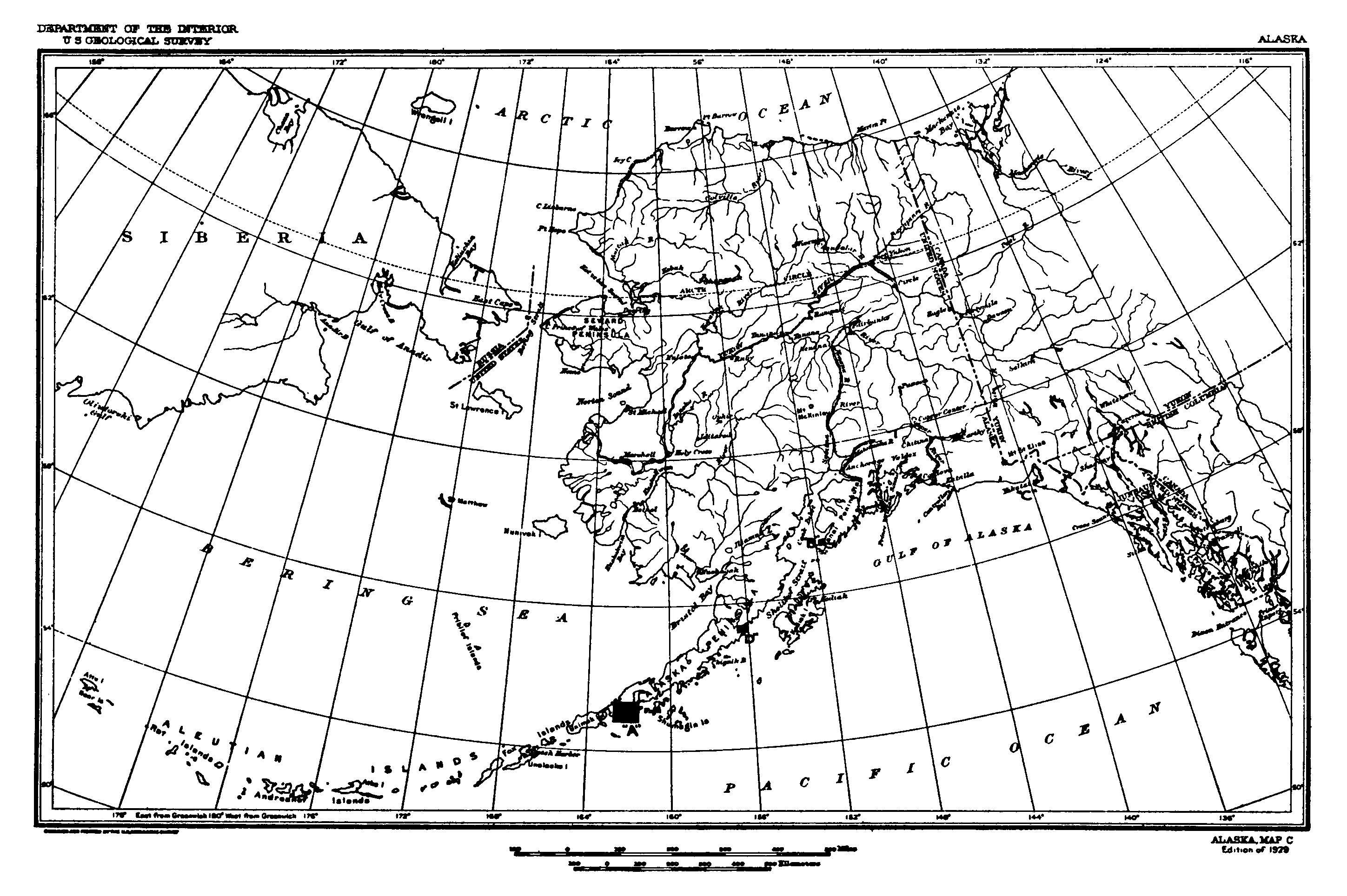
Illustration of areas in Alaska reserved for the Navy Department. This map is an attachment to s:Executive Order 5214 which originally defined the reservation in 1929. The areas concerned were (A) The Cold Bay-Dolgoi Island Area All that area lying between latitude 54° 49′ North and 55° 20′ North, longitude 161° 38′ West and 162° 44′ West; (B) The Port Graham Area All that area lying between latitude 59° 19′ North and 59° 24′ North and longitude 151° 46′ West, 151° 56′ West; (C) The Yakutat Bay Area All that area lying between latitude 59° 32′ North and 59° 36′ North and longitude 139° 44′ West and 139° 50′ West; and (D) The Wide Bay Area All that area lying between latitude 57° 15′ North and 57° 26′ North and longitude 156° 01′ West and 156° 35′ West. |
|||
| Date | ||||
| Source | From Herbert Hoover: Proclamations and Executive Orders, March 4, 1929 to March 4, 1933 (Book 1), University of Michigan scan, on page 443. Extracted from their PDF version. | |||
| Author | U.S. Geological Survey | |||
| Permission (Reusing this file) |
|
File history
Click on a date/time to view the file as it appeared at that time.
| Date/Time | Thumbnail | Dimensions | User | Comment | |
|---|---|---|---|---|---|
| current | 05:19, 26 May 2010 | | 2,897 × 1,928 (267 KB) | Clindberg | {{Information |Description=Illustration of areas in Alaska reserved for the Navy Department. This map is an attachment to s:Executive Order 5214 which originally defined the reservation in 1929. |Source=From [http://quod.lib.umich.edu/cgi/t/text/pagev |
File usage
The following page uses this file: