File:EB9 Texas.jpg
Jump to navigation
Jump to search
Size of this preview: 430 × 599 pixels. Other resolutions: 172 × 240 pixels | 344 × 480 pixels | 551 × 768 pixels | 735 × 1,024 pixels | 1,470 × 2,048 pixels | 3,886 × 5,413 pixels.
Original file (3,886 × 5,413 pixels, file size: 3.49 MB, MIME type: image/jpeg)
| This is a file from the Wikimedia Commons. Information from its description page there is shown below. Commons is a freely licensed media file repository. You can help. |
| Description |
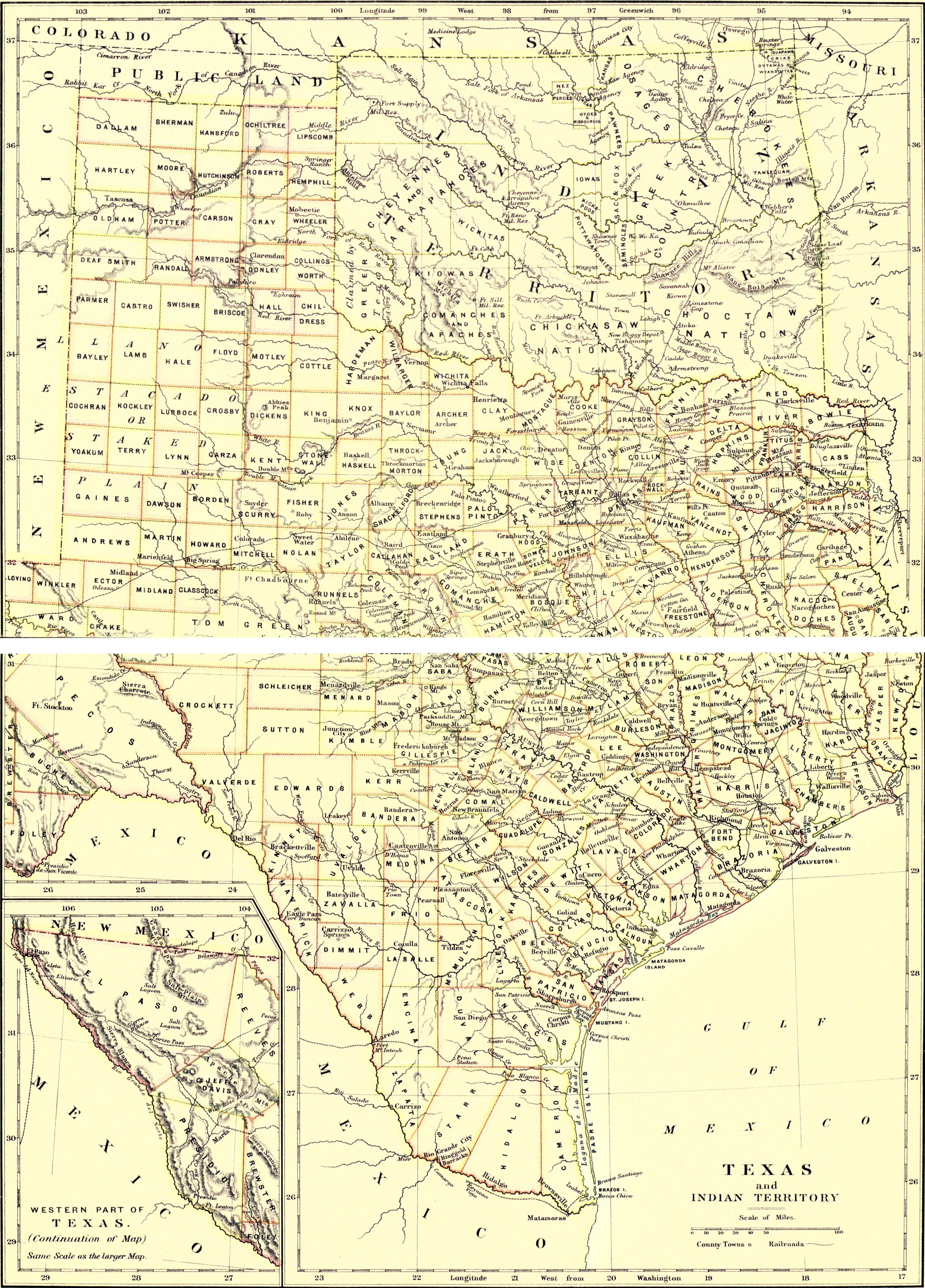
English: Map of Texas and Indian Territory. |
|||
| Date | published 1888 | |||
| Source | Encyclopædia Britannica, v. 23, 1888, between pp. 202 and 203. Two scans of two halves of a plate have been merged into one image. There is a blank strip in the middle of the image where the scans didn't pick up part of the state. | |||
| Author | W. & A. K. Johnston | |||
| Permission (Reusing this file) |
|
|||
| Other versions |
|


File history
Click on a date/time to view the file as it appeared at that time.
| Date/Time | Thumbnail | Dimensions | User | Comment | |
|---|---|---|---|---|---|
| current | 20:36, 24 June 2013 | | 3,886 × 5,413 (3.49 MB) | Bob Burkhardt | {{Information |Description={{en|Map of Texas and Indian Territory.}} |Source=''Encyclopædia Britannica'', v. 23, 1888, between pp. 202 and 203. Two scans of two halves of a plate have been merged into one image. There is a blank strip in the middle ... |
File usage
The following 3 pages use this file: