Transactions of the Geological Society, 1st series, vol. 1/Plates and Maps
PLATES AND MAPS
IN ILLUSTRATION OF
THE FIRST VOLUME
OF THE
TRANSACTIONS
OF
THE GEOLOGICAL SOCIETY.
───────
LONDON:
Printed for the society by William Phillips, George Yard, Lombard street;
and sold by T. Cadell and W. Davis, strand
───────
C O N T E N T S.
General Map of the Channel Islands.
Maps of Guernsey and Sercq.
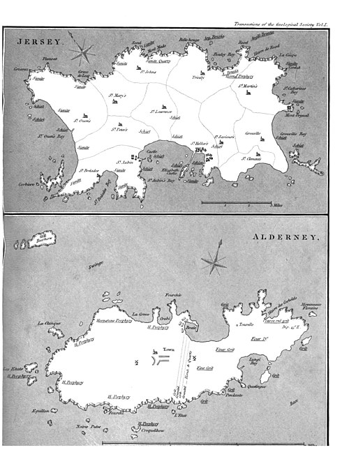
Maps of Jersey and Alderney.
View of the Creux in the Isle of Sercq.
View of the Coupée in the Isle of Sercq.
View of a Granite Vein in Port des Moulins in the Isle of Sercq.
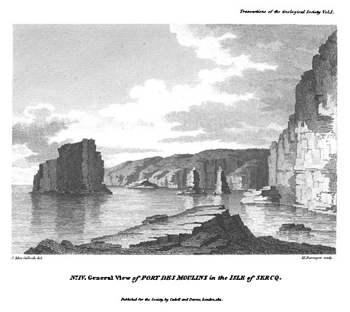
General View of Port des Moulins in the Isle of Sercq.
View of Fourchi Point in the Isle of Alderney.
View in the Greve de Lecq in the Isle of Jersey.
Crystallized Forms of Arseniate of Iron.
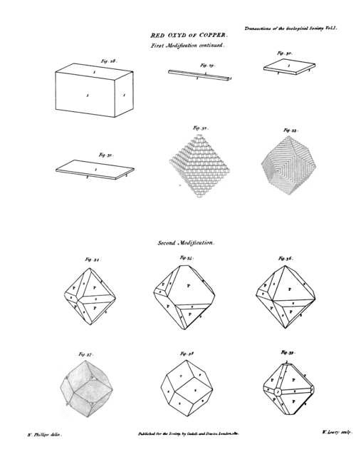
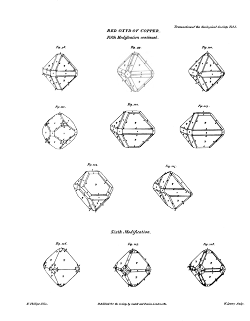
Crystallized Forms of Red Oxyd of Copper, (Nine Plates).
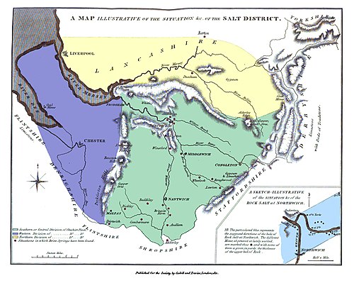
Map illustrative of the Situation of the Cheshire Salt District.
Crystallized Forms of Laumonite, (Two Plates).
Section representing the principal Mineral Formations of the Middle and Eastern Part of Shropshire, in the parallel of the Wrekin. One Plate.
Plan and Sections of the Malvern Hills, and Part of the adjacent Country.
Plan and Sections of the Island of Heligoland.
Crystallized Forms of Bardiglione.
Explanations of the Views, in illustration of Dr. MacCuIloch's: Account of Guernsey, and the other Channel Islands.
No. 1 is a view of the small port and beach of the Creux in the Isle of Sercq, exhibiting the gate of the Tunnel, through which is the only entrance into the island. The adjacent rocks are of trap, and in the distance is seen a detached mass of granite.
No. 2 is a view of the Coupée in the Isle of Sercq, taken from the smaller division of the island, called Petit Sercq. That part of the isthmus, the furthest from the spectator, is traversed by the soft vein mentioned in the Memoir, and is rapidly wearing down.
No. 3 represents one of the granite veins in Port des Moulins in the Isle of Sercq. The grauwacke has been washed away; and part of the granite itself, from the effects of rifts and decomposition, has fallen down; thus making a kind of rude door-way through the vein.
No. 4 is a general view of Port des Moulins. The rocks on the right hand are of grauwacke-slate, as also are the three insulated buttress-like rocks that appear in the distance. Behind the two furthest of these is situated the granite-vein represented in Pl. 3 : the steatitical vein described in the Memoir lies also among the distant cliffs.
No. 5 is a view of Fourchi Point in the Isle of Alderney, representing
the great fracture in the porphyry rock, of which this headland
is composed. The open sea is the passage called the Race of
Alderney, and Cape la Hogue is seen in the distance.
No. 6 is a view taken from the shore in the Greve de Lecq, in the
Isle of Jersey, a coast of very difficult access. The cliffs are
formed of the granite or sienite described in the Memoir, as are
also the two detached rocks advanced in front of the coast. The
most distant of these latter is of a pyramidal shape, and is pierced
through by an arched cavity not visible from this point of view.
The quarries of Mont Mado are not far from this place, and lie
in the same kind of rock as forms these cliffs.
Explanation of the Section, in illustration of Mr. Aikin's Observations on the Wrekin, and on the Great Coal-Field of Shropshire.
Fig 1 is a section through the Wrekin, exhibiting the order in which the mineral beds occur on the E. and W. of that hill.
Fig. 2 represents the horizontal angle formed by such of the beds as
are distinctly stratified, together with the point of the compass
towards which they rise.
A A A. Old Red Sandstone.
B. Independent Coal Formation.
C. A Limestone Formation lying below the Coal.
D. Sandy Slate Clay.
E. Slaty micaceous Greenstone.
F. Quartz-grit.
G. Claystone.
H. Feldspar and greenstone amygdaloid.
I. Greenstone.
K K. Two small Coal-formations at Dryton and Welhach.
L. The Grauwacke of Lyth-hill, upon which rests a patch of
Greenstone I, the old Red Sandstone A, and the Coal-formation
of Welbach K, which latter fills a narrow trough formed by the
junction of the Grauwacke and Sandstone.


