File:EB9 Boston.jpg
Jump to navigation
Jump to search
Size of this preview: 800 × 526 pixels. Other resolutions: 320 × 210 pixels | 640 × 420 pixels | 1,024 × 673 pixels | 1,280 × 841 pixels | 2,559 × 1,681 pixels.
Original file (2,559 × 1,681 pixels, file size: 961 KB, MIME type: image/jpeg)
| This is a file from the Wikimedia Commons. Information from its description page there is shown below. Commons is a freely licensed media file repository. You can help. |
| Description |
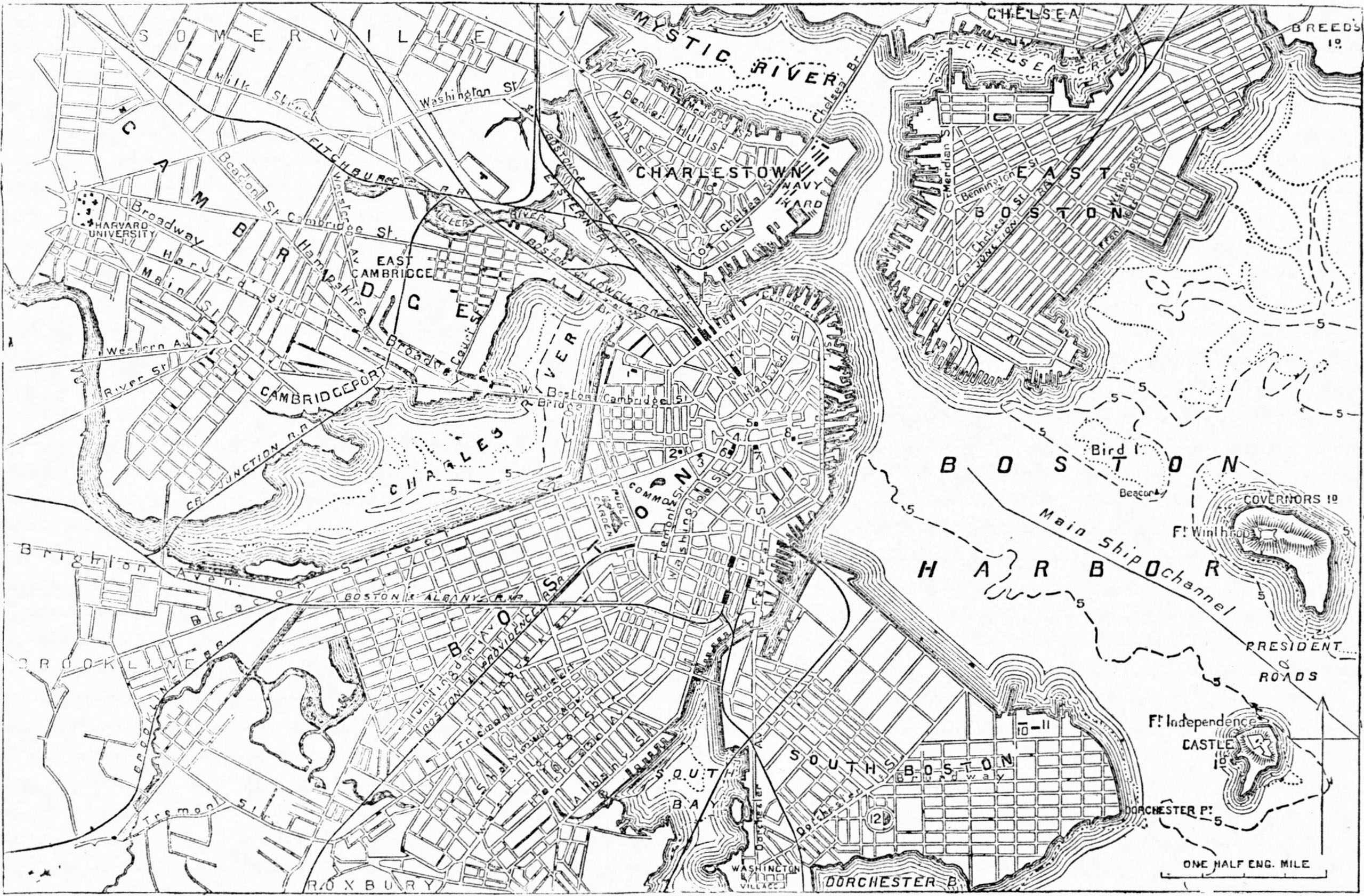
English: Caption: Ground-Plan of the City of Boston. 1. Massachusetts Hospital. 2. State House. 3. Athenæum. 4. Court-House. 5. Faneuil Hall. 6. City Hall. 7. Exchange. 8. Custom House. 9. Bunker's Hill Monument. 10. Insane Hospital. 11. House of Correction. 12. Telegraph Hill (Dorchester Heights) ··················· Low Water mark. – – – – – – 5 Fathom line. |
|||
| Date | published 1878 | |||
| Source | Encyclopædia Britannica (9th ed.), v. 4, 1878, p. 73 | |||
| Author | unknown cartographer | |||
| Permission (Reusing this file) |
|

| Annotations | This image is annotated: View the annotations at Commons |
File history
Click on a date/time to view the file as it appeared at that time.
| Date/Time | Thumbnail | Dimensions | User | Comment | |
|---|---|---|---|---|---|
| current | 23:49, 26 November 2012 | | 2,559 × 1,681 (961 KB) | Bob Burkhardt | {{Information |Description={{en|A plan of Boston.}} |Source=''Encyclopædia Britannica'' (9th ed.), v. 4, 1878, p. 73 |Date=published 1878 |Author=unknown cartographer |Permission={{PD-Britannica}} |other_versions= }} Category:Old maps of Boston |
File usage
The following 2 pages use this file: