There was a problem when proofreading this page.
Worked example
15.13
The following example illustrates how the new TSRGD works.
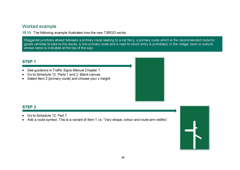
Staggered junctions ahead between a primary route leading to a car ferry, a primary route which is the recommended route for goods vehicles to take to the docks, a non-primary route and a road to which entry is prohibited, in the village, town or suburb whose name is indicated at the top of the sign.
STEP 1
An image should appear at this position in the text. To use the entire page scan as a placeholder, edit this page and replace "{{missing image}}" with "{{raw image|DfT-circular-01-2016.pdf/56}}". Otherwise, if you are able to provide the image then please do so. For guidance, see Wikisource:Image guidelines and Help:Adding images. |
- See guidance in Traffic Signs Manual Chapter 7.
- Go to Schedule 12, Parts 1 and 2. Blank canvas.
- Select Item 2 (primary route) and choose your x-height.
STEP 2
An image should appear at this position in the text. To use the entire page scan as a placeholder, edit this page and replace "{{missing image}}" with "{{raw image|DfT-circular-01-2016.pdf/56}}". Otherwise, if you are able to provide the image then please do so. For guidance, see Wikisource:Image guidelines and Help:Adding images. |
- Go to Schedule 12, Part 7.
- Add a route symbol. This is a variant of Item 1 i.e. "Vary shape, colour and route arm widths".
56