lines have been measured by French officers with Brunner’s apparatus. At present, in Rumania, there is being worked a connexion between the arc of parallel in lat. 47°/48° in Russia (stretching from Astrakan to Kishinev) with Austria-Hungary. In the latter country and in south Bavaria the connecting triangles for this parallel have been recently revised, as well as the French chain on the Paris parallel, which has been connected with the German net by the co-operation of German and French geodesists. This will give a long arc of parallel, really projected in the first half of the 19th century. The calculation of the Russian section gives, with an assumed ellipticity of 1/299·15, the value =6377350 metres; this is rather uncertain, since the arc embraces only 19° in longitude.

We may here recall that in France geodetic studies have recovered their former expansion under the vigorous impulse of Colonel (afterwards General) François Perrier. When occupied with the triangulation of Algeria, Colonel Perrier had conceived the possibility of the geodetic junction of Algeria to Spain, over the Mediterranean; therefore the French meridian line, which was already connected with England, and was thus produced to the 60th parallel, could further be linked to the Spanish triangulation, cross thence into Algeria and extend to the Sahara, so as to form an arc of about 30° in length. But it then became urgent to proceed to a new measurement of the French arc, between Dunkirk and Perpignan. In 1869 Perrier was authorized to undertake that revision. He devoted himself to that work till the end of his career, closed by premature death in February 1888, at the very moment when the Dépôt de la guerre had just been transformed into the Geographical Service of the Army, of which General F. Perrier was the first director. His work was continued by his assistant, Colonel (afterwards General) J. A. L. Bassot. The operations concerning the revision of the French arc were completed only in 1896. Meanwhile the French geodesists had accomplished the junction of Algeria to Spain, with the help of the geodesists of the Madrid Institute under General Carlos Ibañez (1879), and measured the meridian line between Algiers and El Aghuat (1881). They have since been busy in prolonging the meridians of El Aghuat and Biskra, so as to converge towards Wargla, through Ghardaïa and Tuggurt. The fundamental co-ordinates of the Panthéon have also been obtained anew, by connecting the Panthéon and the Paris Observatory with the five stations of Bry-sur-Marne, Morlu, Mont Valérien, Chatillon and Montsouris, where the observations of latitude and azimuth have been effected.[1]
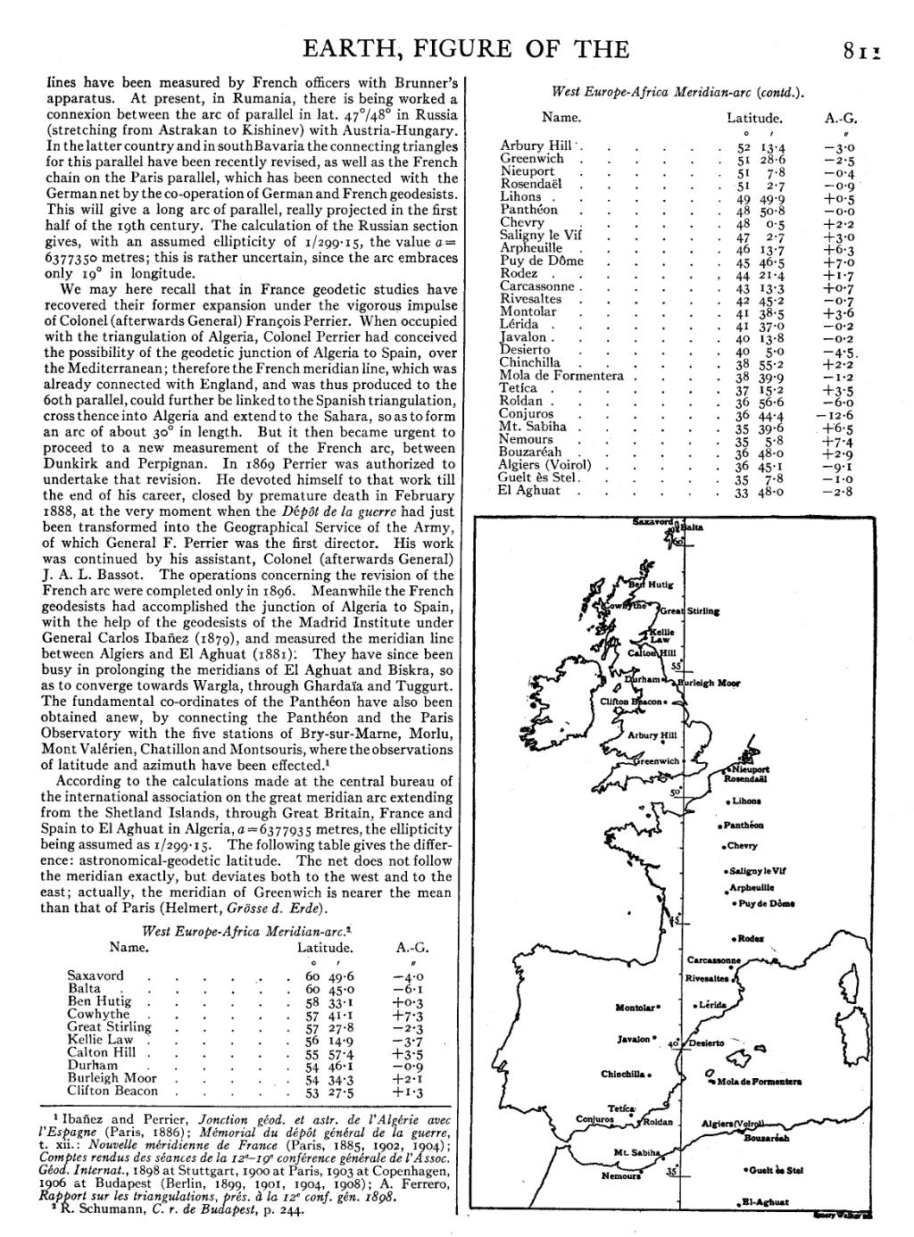
According to the calculations made at the central bureau of the international association on the great meridian arc extending from the Shetland Islands, through Great Britain, France and Spain to El Aghuat in Algeria, =6377935 metres, the ellipticity being assumed as 1/299·15. The following table gives the difference: astronomical-geodetic latitude. The net does not follow the meridian exactly, but deviates both to the west and to the east; actually, the meridian of Greenwich is nearer the mean than that of Paris (Helmert, Grösse d. Erde).
West Europe-Africa Meridian-arc.[2]
| Name. | Latitude. | A.-G. | |
| ° | ′ | ″ | |
| Saxavord | 60 | 49·6 | −4·0 |
| Balta | 60 | 45·0 | −6·1 |
| Ben Hutig | 58 | 33·1 | +0·3 |
| Cowhythe | 57 | 41·1 | +7·3 |
| Great Stirling | 57 | 27·8 | −2·3 |
| Kellie Law | 56 | 14·9 | −3·7 |
| Calton Hill | 55 | 57·4 | +3·5 |
| Durham | 54 | 46·1 | −0·9 |
| Burleigh Moor | 54 | 34·3 | +2·1 |
| Clifton Beacon | 53 | 27·5 | +1·3 |
| Arbury Hill | 52 | 13·4 | −3·0 |
| Greenwich | 51 | 28·6 | −2·5 |
| Nieuport | 51 | 7·8 | −0·4 |
| Rosendaël | 51 | 2·7 | −0·9 |
| Lihons | 49 | 49·9 | +0·5 |
| Panthéon | 48 | 50·8 | −0·0 |
| Chevry | 48 | 0·5 | +2·2 |
| Saligny le Vif | 47 | 2·7 | +3·0 |
| Arpheuille | 46 | 13·7 | +6·3 |
| Puy de Dôme | 45 | 46·5 | +7·0 |
| Rodez | 44 | 21·4 | +1·7 |
| Carcassonne | 43 | 13·3 | +0·7 |
| Rivesaltes | 42 | 45·2 | −0·7 |
| Montolar | 41 | 38·5 | +3·6 |
| Lérida | 41 | 37·0 | −0·2 |
| Javalon | 40 | 13·8 | −0·2 |
| Desierto | 40 | 5·0 | −4·5 |
| Chinchilla | 38 | 55·2 | +2·2 |
| Mola de Formentera | 38 | 39·9 | −1·2 |
| Tetíca | 37 | 15·2 | +3·5 |
| Roldan | 36 | 56·6 | −6·0 |
| Conjuros | 36 | 44·4 | −12·6 |
| Mt. Sabiha | 35 | 39·6 | +6·5 |
| Nemours | 35 | 5·8 | +7·4 |
| Bouzaréah | 36 | 48·0 | +2·9 |
| Algiers (Voirol) | 36 | 45·1 | −9·1 |
| Guelt ès Stel | 35 | 7·8 | −1·0 |
| El Aghuat | 33 | 48·0 | −2·8 |
 |
- ↑ Ibañez and Perrier, Jonction géod. et astr. de l’Algérie avec l’Espagne (Paris, 1886); Mémorial du dépôt général de la guerre, t. xii.: Nouvelle méridienne de France (Paris, 1885, 1902, 1904); Comptes rendus des séances de la 12ᵉ–19ᵉ conférence générale de l’Assoc. Géod. Internat., 1898 at Stuttgart, 1900 at Paris, 1903 at Copenhagen, 1906 at Budapest (Berlin, 1899, 1901, 1904, 1908); A. Ferrero, Rapport sur les triangulations, prés. à la 12ᵉ conf. gén. 1898.
- ↑ R. Schumann, C. r. de Budapest, p. 244.