following the route of Hanno, along the west coast. Among geographers should be mentioned Posidonius (135–51), the head of the Stoic school of Rhodes, who is stated to be responsible for having reduced the length of a degree to 500 stadia; Artemidorus of Ephesus, whose “Geographumena” (c. 100 B.C.) are based upon his own travels and a study of itineraries, and above all, Strabo, who has already been referred to. Among historians who looked upon geography as an important aid in their work are numbered Polybius (c. 210–120 B.C.), Diodorus Siculus (c. 30 B.C.) and Agathachidus of Cnidus (c. 120 B.C.) to whom we are indebted for a valuable account of the Erythrean Sea and the adjoining parts of Arabia and Ethiopia. The Periegesis of Dionysius of Alexandria is a popular description of the world in hexameters, of no particular scientific value (c. A.D. 130). He as well as Artemidorus and others accepted a circular or ellipsoidal shape of the world and a circumfluent ocean; Strabo alone adhered to the scientific theories of Eratosthenes.
The credit of having returned to the scientific principles innovated by Eratosthenes and Hipparchus is due to Marinus of Tyre (c. A.D. 120) which, though no longer occupying the pre-eminent position of former times, was yet an emporium of no inconsiderable importance, having extensive connexions by sea and land. The map of Marinus and the descriptive accounts which accompanied it have perished, but we learn sufficient concerning them from Ptolemy to be able to appreciate their merits and demerits. Marinus was the first who laid down the position of places on a projection according to their latitude and longitude, but the projection used by him was of the rudest. Parallels and meridians were represented by straight lines intersecting each other at right angles, the relative proportions between degrees of longitude and latitude being retained only along the parallel of Rhodes. The distortion of the countries represented would thus increase with the distance, north and south, from this central parallel. The number of places whose position had been determined by astronomical observation was as yet very small, and the map had thus to be compiled mainly from itineraries furnished by travellers or the dead reckoning of seamen. The errors due to an exaggeration of distances were still further increased on account of his assuming a degree to be equal to 500 stadia, as determined by Posidonius, instead of accepting the 700 stadia of Eratosthenes. He was thus led to assume that the distance from the first meridian drawn through the Fortunate islands to Sera (mod. Si-ngan-fu), the capital of China, was equal to 225°, which Ptolemy reduced to 177°, but which in reality only amount to 126°. A like overestimate of the distances covering the march of Julius Maternus to Agisymba, which Marinus places 24° south of the equator, a latitude which Ptolemy reduces to 18°, but which is probably no farther south than lat. 12° N. The map of Marinus was accompanied by a list of places arranged according to latitude and longitude. It must have been much in demand, for three editions of it were prepared. Masudi (10th century) saw a copy of it and declared it to be superior to Ptolemy’s map.
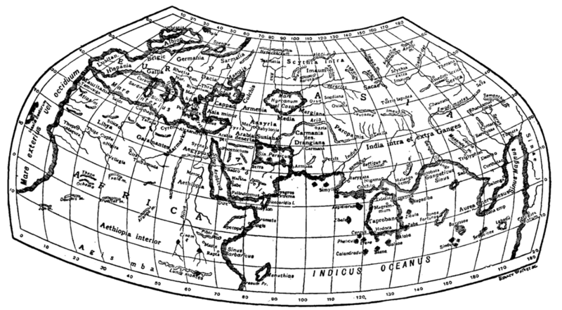
Ptolemy (q.v.) was the author of a Geography[1] (c. A.D. 150) in eight books. “Geography,” in the sense in which he uses the term, signifies the delineation of the known world, in the shape of a map, while chorography carries out the same objects in fuller detail, with regard to a particular country. In Book I. he deals with the principles of mathematical geography, map projections, and sources of information with special reference to his predecessor Marinus.
Books II. to VII. form an index to the maps. They contain about 8000 names,
- ↑ The oldest MS. of Ptolemy's Geography is found in the Vatopedi monastery of Mt Athos. It dates from the 12th or 13th century and was published by Victor Langlois in 1867. For the latest edition we are indebted to the late Carl Müller (Paris, 1883–1906) to whom we are likewise indebted for an edition of the Geographi graeci minores (1855–1861).


