proposition. It is to be lamented, for another survey would give data by which we could translate into time nearly half a mile of the channel. Until the Falls shall be examined again by instrumentation, in estimating the rate of recession we must depend on the eye alone.
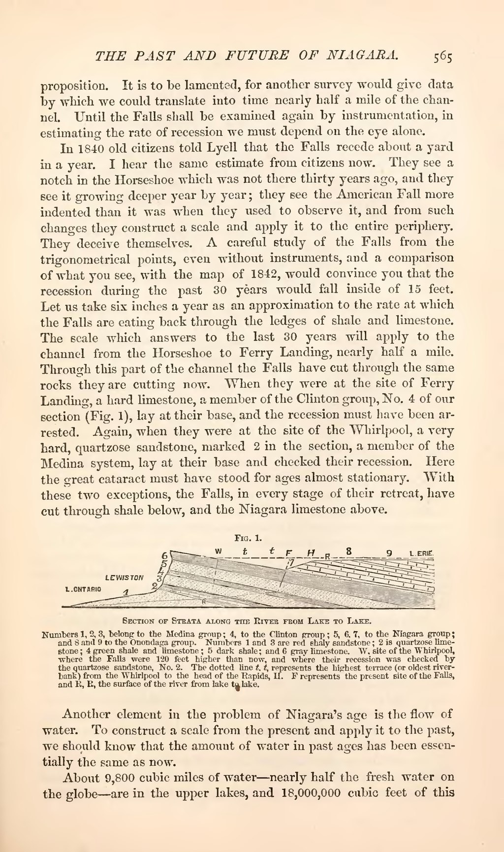
In 1840 old citizens told Lyell that the Falls recede about a yard in a year. I hear the same estimate from citizens now. They see a notch in the Horseshoe which was not there thirty years ago, and they see it growing deeper year by year; they see the American Fall more indented than it was when they used to observe it, and from such changes they construct a scale and apply it to the entire periphery. They deceive themselves. A careful study of the Falls from the trigonometrical points, even without instruments, and a comparison of what you see, with the map of 1842, would convince you that the recession during the past 30 years would fall inside of 15 feet. Let us take six inches a year as an approximation to the rate at which the Falls are eating back through the ledges of shale and limestone. The scale which answers to the last 30 years will apply to the channel from the Horseshoe to Ferry Landing, nearly half a mile. Through this part of the channel the Falls have cut through the same rocks they are cutting now. When they were at the site of Ferry Landing, a hard limestone, a member of the Clinton group, No. 4 of our section (Fig. 1), lay at their base, and the recession must have been arrested. Again, when they were at the site of the Whirlpool, a very hard, quartzose sandstone, marked 2 in the section, a member of the Medina system, lay at their base and checked their recession. Here the great cataract must have stood for ages almost stationary. With these two exceptions, the Falls, in every stage of their retreat, have cut through shale below, and the Niagara limestone above.

Section of Strata along the River from Lake to Lake
Another element in the problem of Niagara's age is the flow of water. To construct a scale from the present and apply it to the past, we should know that the amount of water in past ages has been essentially the same as now.
About 9,800 cubic miles of water—nearly half the fresh water on the globe—are in the upper lakes, and 18,000,000 cubic feet of this