upper deposit to have been formed under different conditions, but whilst, generally speaking, the fauna was the same throughout the area.
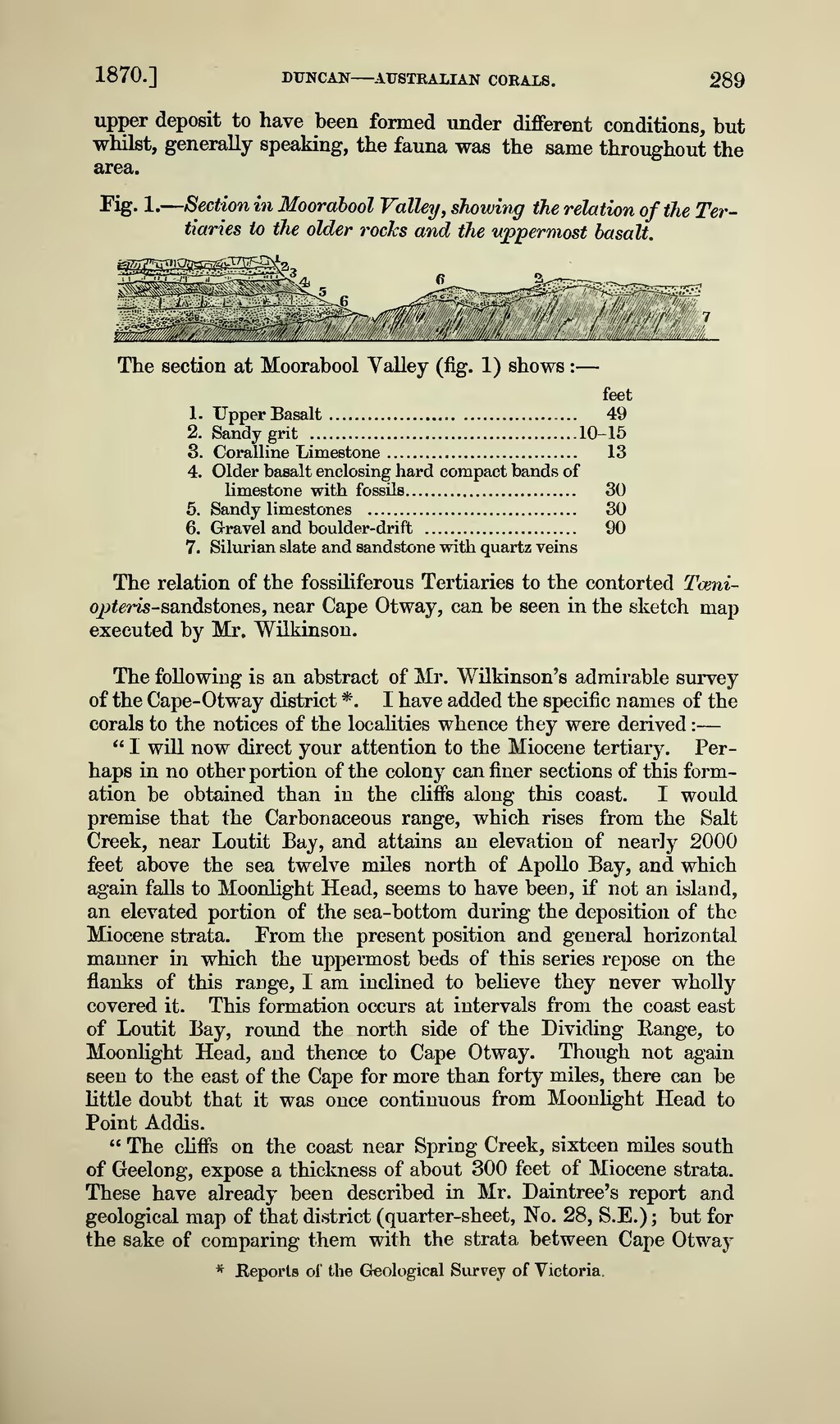
Fig. 1. — Section in Moorabool Valley, showing the relation of the Tertiaries to the older rocks and the uppermost basalt.
The section at Moorabool Valley (fig. 1) shows : —
feet
1. Upper Basalt 49
2. Sandy grit 10-15
3. Coralline Limestone 13
4. Older basalt enclosing hard compact bands of limestone with fossils 30
5. Sandy limestones 30
6. Gravel and boulder-drift 90
7. Silurian slate and sandstone with quartz veins
The relation of the fossiliferous Tertiaries to the contorted Toeniopteris-sandstones, near Cape Otway, can be seen in the sketch map executed by Mr. Wilkinson.
The following is an abstract of Mr. Wilkinson's admirable survey of the Cape-Otway district *. I have added the specific names of the corals to the notices of the localities whence they were derived : —
" I will now direct your attention to the Miocene tertiary. Perhaps in no other portion of the colony can finer sections of this formation be obtained than in the cliffs along this coast. I would premise that the Carbonaceous range, which rises from the Salt Creek, near Loutit Bay, and attains an elevation of nearly 2000 feet above the sea twelve miles north of Apollo Bay, and which again falls to Moonlight Head, seems to have been, if not an island, an elevated portion of the sea-bottom during the deposition of the Miocene strata. From the present position and general horizontal manner in which the uppermost beds of this series repose on the flanks of this range, I am inclined to believe they never wholly covered it. This formation occurs at intervals from the coast east of Loutit Bay, round the north side of the Dividing Range, to Moonlight Head, and thence to Cape Otway. Though not again seen to the east of the Cape for more than forty miles, there can be little doubt that it was once continuous from Moonlight Head to Point Addis.
" The cliffs on the coast near Spring Creek, sixteen miles south of Geelong, expose a thickness of about 300 feet of Miocene strata. These have already been described in Mr. Daintree's report and geological map of that district (quarter-sheet, No. 28, S.E.) ; but for the sake of comparing them with the strata between Cape Otway
- Reports of the Geological Survey of Victoria.