File:Collier's 1921 Michigan.jpg
Jump to navigation
Jump to search

Size of this preview: 494 × 599 pixels. Other resolutions: 198 × 240 pixels | 396 × 480 pixels | 633 × 768 pixels | 845 × 1,024 pixels | 1,941 × 2,353 pixels.
Original file (1,941 × 2,353 pixels, file size: 1.18 MB, MIME type: image/jpeg)
| This is a file from the Wikimedia Commons. Information from its description page there is shown below. Commons is a freely licensed media file repository. You can help. |
| Description |
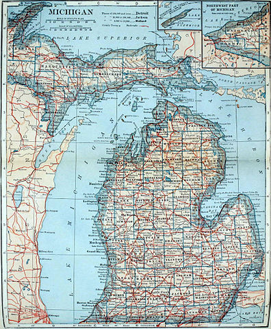
English: Topographical and political map of the state of Michigan. |
||
| Date | |||
| Source | Collier's New Encyclopedia, v. 6, 1921, facing p. 217. | ||
| Author | L. L. Poates Eng. Co. | ||
| Permission (Reusing this file) |
|
File history
Click on a date/time to view the file as it appeared at that time.
| Date/Time | Thumbnail | Dimensions | User | Comment | |
|---|---|---|---|---|---|
| current | 16:37, 12 April 2013 | | 1,941 × 2,353 (1.18 MB) | Bob Burkhardt | {{Information |Description={{en|Topographical and political map of the state of Michigan.}} |Source=''Collier's New Encyclopedia'', v. 6, 1921, facing p. 217. |Date=1921 |Author=L. L. Poates Eng. Co. |Permission={{PD-1923}} |other_versions= }} [[Catego... |
File usage
The following 2 pages use this file: