File:EB9 Kentucky.jpg
Jump to navigation
Jump to search
Size of this preview: 800 × 584 pixels. Other resolutions: 320 × 234 pixels | 640 × 467 pixels | 1,024 × 748 pixels | 1,280 × 935 pixels | 2,560 × 1,869 pixels | 3,720 × 2,716 pixels.
Original file (3,720 × 2,716 pixels, file size: 1.97 MB, MIME type: image/jpeg)
| This is a file from the Wikimedia Commons. Information from its description page there is shown below. Commons is a freely licensed media file repository. You can help. |
Summary
| Description |
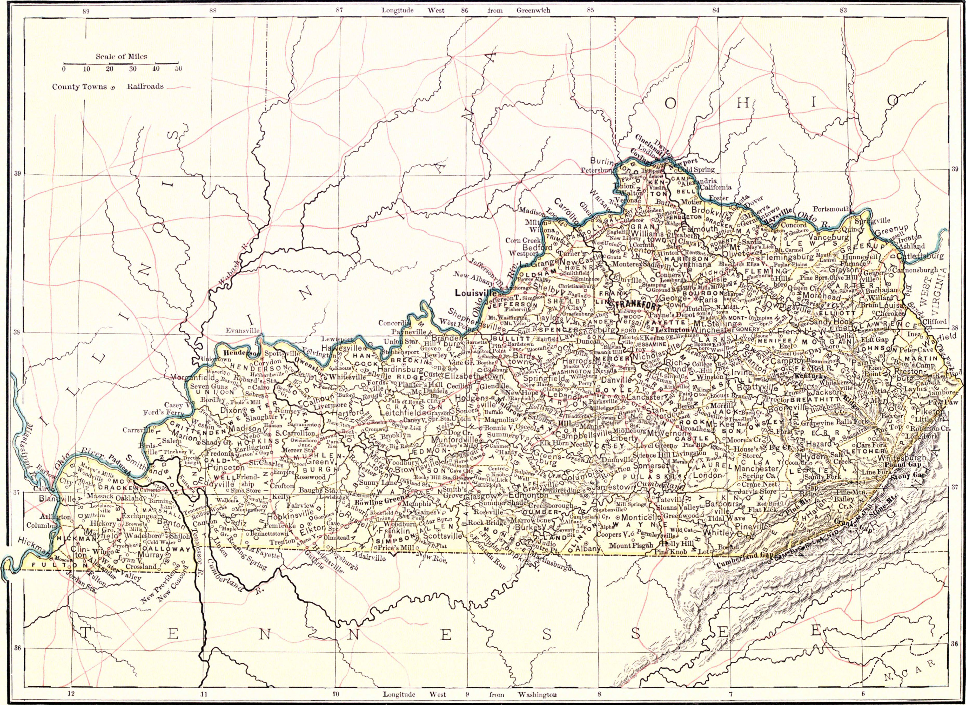
English: Map of Kentucky. |
|||
| Date | ||||
| Source | Encyclopædia Britannica, 9th ed., Vol. XIV, facing p. 41. | |||
| Author | Anonymous, but presumably engraved by John Bartholomew & Son or William & Alexander Keith Johnston, both of Edinburgh, Scotland. | |||
| Permission (Reusing this file) |
|

File history
Click on a date/time to view the file as it appeared at that time.
| Date/Time | Thumbnail | Dimensions | User | Comment | |
|---|---|---|---|---|---|
| current | 18:17, 30 June 2013 | | 3,720 × 2,716 (1.97 MB) | Bob Burkhardt | {{Information |Description={{en|Map of Minnesota, showing towns, counties and topography.}} |Source=''Encyclopædia Britannica'', v. 14, 1882, facing p. 41. |Date=published 1882 |Author=not specified; other maps of this type were done by W. & A. K. Joh... |
File usage
The following 2 pages use this file: