File:EB9 St Paul.jpg
Jump to navigation
Jump to search

Size of this preview: 800 × 550 pixels. Other resolutions: 320 × 220 pixels | 640 × 440 pixels | 837 × 575 pixels.
Original file (837 × 575 pixels, file size: 165 KB, MIME type: image/jpeg)
| This is a file from the Wikimedia Commons. Information from its description page there is shown below. Commons is a freely licensed media file repository. You can help. |
Summary
| Description |
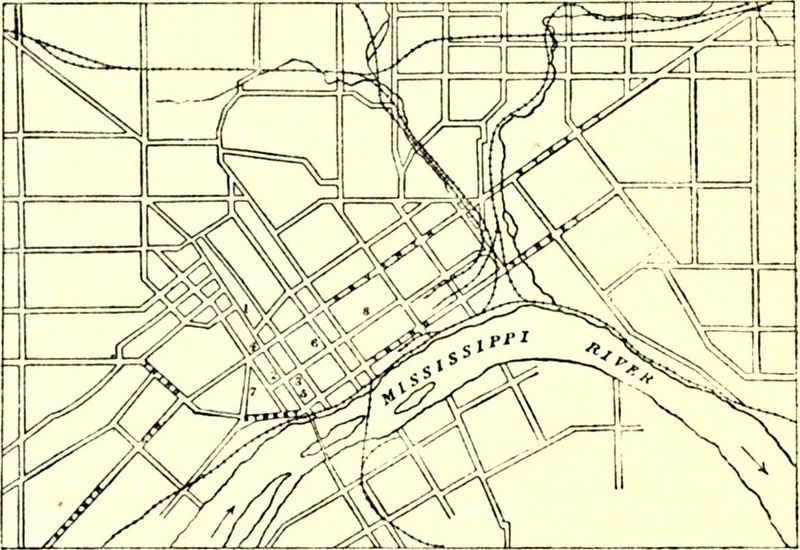
English: Caption: Plan of St Paul. 1. State Capitol. |
|||
| Date | ||||
| Source | Encyclopædia Britannica, 9th ed., Vol. XXI, p. 188. | |||
| Author | Anonymous, presumably engraved by John Bartholomew & Son or William & Alexander Keith Johnston | |||
| Permission (Reusing this file) |
|

| Annotations | This image is annotated: View the annotations at Commons |
| Annotations | This image is annotated: View the annotations at Commons |
File history
Click on a date/time to view the file as it appeared at that time.
| Date/Time | Thumbnail | Dimensions | User | Comment | |
|---|---|---|---|---|---|
| current | 18:30, 9 June 2014 | | 837 × 575 (165 KB) | Library Guy | {{Information |Description ={{en|1=A street map of St. Paul, Minnesota.}} |Source =''Encyclopædia Britannica'' (9th ed.), v. 21, 1886, p. 188. |Author =unknown cartographer |Date =published 1886 |Permission ={{PD-Brita... |
File usage
The following 2 pages use this file: