File:Map Asia physical (continental).png
Jump to navigation
Jump to search

Size of this preview: 800 × 461 pixels. Other resolutions: 320 × 184 pixels | 640 × 368 pixels | 1,024 × 590 pixels | 1,280 × 737 pixels | 3,196 × 1,840 pixels.
Original file (3,196 × 1,840 pixels, file size: 13.24 MB, MIME type: image/png)
| This is a file from the Wikimedia Commons. Information from its description page there is shown below. Commons is a freely licensed media file repository. You can help. |
Summary
| Description |
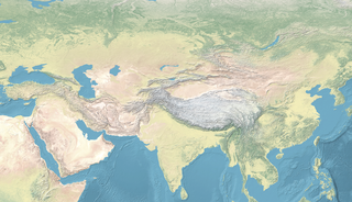
English: Map Asia physical (continental) |
| Date | |
| Source | |
| Author | naturalearthdata.com, offered to the Public Domain per Terms of Use |
.png)
.png)
Licensing
This file is licensed under the Creative Commons Attribution-Share Alike 4.0 International license.
- You are free:
- to share – to copy, distribute and transmit the work
- to remix – to adapt the work
- Under the following conditions:
- attribution – You must give appropriate credit, provide a link to the license, and indicate if changes were made. You may do so in any reasonable manner, but not in any way that suggests the licensor endorses you or your use.
- share alike – If you remix, transform, or build upon the material, you must distribute your contributions under the same or compatible license as the original.
File history
Click on a date/time to view the file as it appeared at that time.
| Date/Time | Thumbnail | Dimensions | User | Comment | |
|---|---|---|---|---|---|
| current | 15:57, 4 February 2023 | | 3,196 × 1,840 (13.24 MB) | पाटलिपुत्र | less ice... |
| 15:53, 4 February 2023 |  | 3,196 × 2,013 (14.24 MB) | पाटलिपुत्र | Uploaded a work by Ktrinko from {{extracted from|File:Eckert4.jpg}} with UploadWizard |
File usage
There are no pages that use this file.
Global file usage
The following other wikis use this file:
- Usage on en.wikipedia.org
- Durrani Empire
- Göktürks
- Khazars
- Qing dynasty
- Seleucid Empire
- Yerevan
- Sui dynasty
- Qin dynasty
- Zhou dynasty
- Turkic peoples
- Pannonian Avars
- Sumer
- Jin dynasty (266–420)
- Jin dynasty (1115–1234)
- Scythians
- Fatimid Caliphate
- Western Xia
- Xiongnu
- Northern Wei
- Pazyryk burials
- Almaty
- Wusun
- Saka
- Khanate of Sibir
- Kara-Khanid Khanate
- Tocharians
- Tian Shan
- Ayyubid dynasty
- Zengid dynasty
- Khmer Empire
- Gupta Empire
- Middle Kingdom of Egypt
- Delhi Sultanate
- Dzungar Khanate
- Hephthalites
- Yuezhi
- Rouran Khaganate
- Shanidar Cave
- Kushan Empire
- Ubaid period
- Zhang Qian
- Southern Qi
- Chen dynasty
- Northern Liang
- Vijayanagara Empire
- Nanzhao
- Dvaravati
- Liangzhu culture
- Maurya Empire
- Ghaznavids
View more global usage of this file.
.png)
.png)