File:Map by Chief Ochagach for Verendrye.jpg
Jump to navigation
Jump to search
Size of this preview: 800 × 282 pixels. Other resolutions: 320 × 113 pixels | 640 × 226 pixels | 1,024 × 361 pixels | 1,280 × 451 pixels | 3,296 × 1,162 pixels.
Original file (3,296 × 1,162 pixels, file size: 420 KB, MIME type: image/jpeg)
| This is a file from the Wikimedia Commons. Information from its description page there is shown below. Commons is a freely licensed media file repository. You can help. |
Summary
| Description |
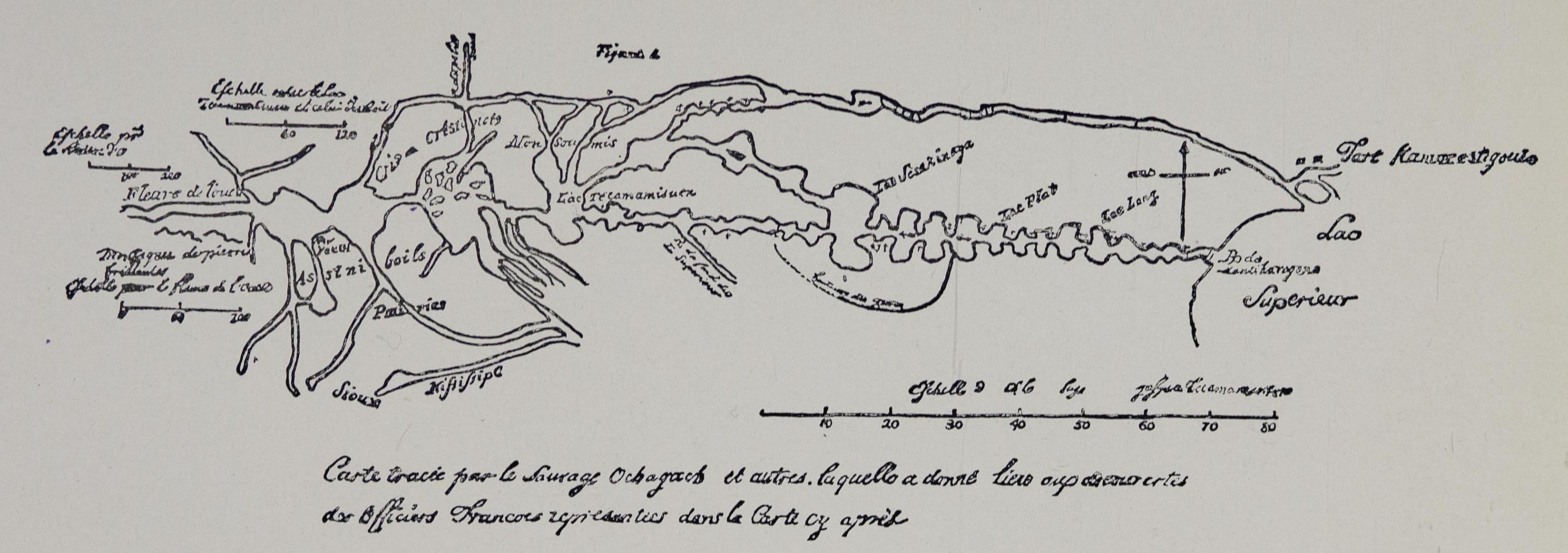
English: Map drawn on birch bark by Chief Ochagach for Verendrye, about 1729 |
| Date | |
| Source | https://open.library.ubc.ca/viewer/bcbooks/1.0342742#p143z-3r0f: |
| Author | Chief Ochagach |
Licensing
|
This work is in the public domain in its country of origin and other countries and areas where the copyright term is the author's life plus 70 years or fewer. This work is in the public domain in the United States because it was published (or registered with the U.S. Copyright Office) before January 1, 1929. | |
| This file has been identified as being free of known restrictions under copyright law, including all related and neighboring rights. | |
File history
Click on a date/time to view the file as it appeared at that time.
| Date/Time | Thumbnail | Dimensions | User | Comment | |
|---|---|---|---|---|---|
| current | 19:49, 3 August 2021 | 3,296 × 1,162 (420 KB) | Peteforsyth | Cropped 53 % horizontally, 76 % vertically, rotated 90° using CropTool with lossless mode. | |
| 19:46, 3 August 2021 |  | 6,964 × 4,794 (3.09 MB) | Peteforsyth | Uploaded a work by Chief Ochagach from https://open.library.ubc.ca/viewer/bcbooks/1.0342742#p143z-3r0f: with UploadWizard |
File usage
The following 2 pages use this file: