File:NIE 1905 America - North - political map.jpg
Jump to navigation
Jump to search

Size of this preview: 524 × 599 pixels. Other resolutions: 210 × 240 pixels | 420 × 480 pixels | 672 × 768 pixels | 895 × 1,024 pixels | 1,854 × 2,120 pixels.
Original file (1,854 × 2,120 pixels, file size: 871 KB, MIME type: image/jpeg)
| This is a file from the Wikimedia Commons. Information from its description page there is shown below. Commons is a freely licensed media file repository. You can help. |
| Description |
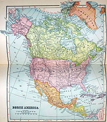
English: Political map of North America (including Mexico and Central America). |
||
| Date | |||
| Source | The New International Encyclopædia, v. 1, 1905, between pp. 442 and 443 (first plate) | ||
| Author | Dodd, Mead & Company | ||
| Permission (Reusing this file) |
|
File history
Click on a date/time to view the file as it appeared at that time.
| Date/Time | Thumbnail | Dimensions | User | Comment | |
|---|---|---|---|---|---|
| current | 19:03, 2 June 2013 | | 1,854 × 2,120 (871 KB) | Bob Burkhardt | {{Information |Description={{en|Political map of North America (including Mexico and Central America).}} |Source=''The New International Encyclopædia'', v. 1, 1905, between pp. 442 and 443 (first plate) |Date=1902 |Author=Dodd, Mead & Company |Permiss... |
File usage
The following 2 pages use this file: