File:Obcine Slovenija 2006 Kanal.svg
Jump to navigation
Jump to search

Size of this PNG preview of this SVG file: 800 × 522 pixels. Other resolutions: 320 × 209 pixels | 640 × 418 pixels | 1,024 × 668 pixels | 1,280 × 835 pixels | 2,560 × 1,670 pixels | 2,613 × 1,705 pixels.
Original file (SVG file, nominally 2,613 × 1,705 pixels, file size: 2.36 MB)
| This is a file from the Wikimedia Commons. Information from its description page there is shown below. Commons is a freely licensed media file repository. You can help. |
Summary
| Description |
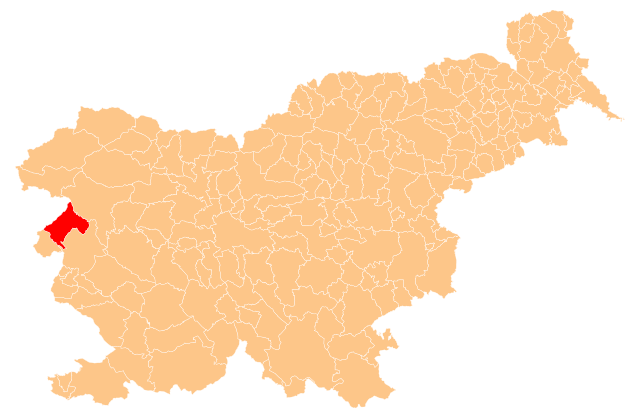
English: Občina Kanal ob Soči (marked red) on map of the municipalities (občine) of the Republic of Slovenia, as since May 2006 (210 units). |
| Date | |
| Source | Manipulated Image:Obcine Slovenija 2006.svg in text editor. |
| Author | Source of the public data is GURS (Geodetska uprava Republike Slovenije or Surveying and Mapping Authority of the Republic of Slovenia). Converted from Shapefile to SVG with shp2svg and prepared for Wikipedia by romanm (talk). |
| Permission (Reusing this file) |
Public domain. See Image:Obcine Slovenija 2006.svg for an explanation. |
Licensing
| I, the copyright holder of this work, release this work into the public domain. This applies worldwide. In some countries this may not be legally possible; if so: I grant anyone the right to use this work for any purpose, without any conditions, unless such conditions are required by law. |
File history
Click on a date/time to view the file as it appeared at that time.
| Date/Time | Thumbnail | Dimensions | User | Comment | |
|---|---|---|---|---|---|
| current | 21:19, 25 May 2009 | | 2,613 × 1,705 (2.36 MB) | Romanm | {{Information |Description={{en|1=''Občina Kanal ob Soči'' (marked red) on map of the municipalities (''občine'') of the Republic of Slovenia, as since May 2006 (210 units).}} |Source=Manipulated Image:Obcine Slovenija 2006.svg in text editor. |Au |
File usage
There are no pages that use this file.
Global file usage
The following other wikis use this file:
- Usage on en.wikipedia.org
- Kanal, Kanal
- Banjšice Plateau
- Anton Nanut
- Avče
- Template:Kanal
- Ajba
- Anhovo
- Bodrež, Kanal
- Deskle
- Doblar
- Gorenja Vas, Kanal
- Kal nad Kanalom
- Kambreško
- Kanalski Vrh
- Krstenica
- Levpa
- Lig
- Morsko, Kanal
- Plave, Kanal
- Ročinj
- Seniški Breg
- Ukanje
- Zapotok, Kanal
- Josip Ribičič
- Marij Kogoj
- Gorenje Nekovo
- Dolenje Nekovo
- Gorenje Polje, Kanal
- Zagomila
- Zagora, Kanal
- Paljevo, Kanal
- Valentin Stanič
- Čolnica
- Goljevica
- Jesen
- Kamenca nad Ložicami
- Ložice
- Močila
- Prilesje pri Plavah
- Ravna, Kanal
- Robidni Breg
- Municipality of Kanal ob Soči
- Usage on eo.wikipedia.org
- Usage on hr.wikipedia.org
- Usage on ja.wikipedia.org
- Usage on pl.wikipedia.org
- Usage on ru.wikipedia.org
- Usage on sh.wikipedia.org
- Usage on sl.wikipedia.org
- Usage on uk.wikipedia.org
View more global usage of this file.