File:SASH D016 Topographical map of syria.jpg
Jump to navigation
Jump to search

Size of this preview: 368 × 599 pixels. Other resolutions: 147 × 240 pixels | 295 × 480 pixels | 472 × 768 pixels | 629 × 1,024 pixels | 2,394 × 3,896 pixels.
Original file (2,394 × 3,896 pixels, file size: 3.16 MB, MIME type: image/jpeg)
| This is a file from the Wikimedia Commons. Information from its description page there is shown below. Commons is a freely licensed media file repository. You can help. |
Summary
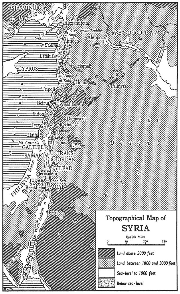
| Description |
Topographical map of Syria العربية: الخريطة الطبوغرافية لسوريا، أحد دول بلاد الشام |
|||
| Date | ||||
| Source | http://en.wikisource.org/wiki/Page:PhilipK.Hitti-SyriaAShortHistory.djvu/16 | |||
| Author | Philip Khuri Hitti | |||
| Permission (Reusing this file) |
|

File history
Click on a date/time to view the file as it appeared at that time.
| Date/Time | Thumbnail | Dimensions | User | Comment | |
|---|---|---|---|---|---|
| current | 00:03, 19 October 2010 | | 2,394 × 3,896 (3.16 MB) | Ineuw | {{Information |Description= Topographical map of Syria |Source= http://en.wikisource.org/wiki/Page:PhilipK.Hitti-SyriaAShortHistory.djvu/16 |Date= 1959 |Author= Philip Khuri Hitti |Permission= {{PD-US-not renewed}} |other_versions= }} [[Category:Syria |
File usage
The following 3 pages use this file:
Global file usage
The following other wikis use this file:
- Usage on ar.wikipedia.org