File:Simeon DeWitt Otsego County NY c.1792.png
Jump to navigation
Jump to search
Size of this preview: 418 × 599 pixels. Other resolutions: 167 × 240 pixels | 335 × 480 pixels | 729 × 1,044 pixels.
Original file (729 × 1,044 pixels, file size: 431 KB, MIME type: image/png)
| This is a file from the Wikimedia Commons. Information from its description page there is shown below. Commons is a freely licensed media file repository. You can help. |
Summary
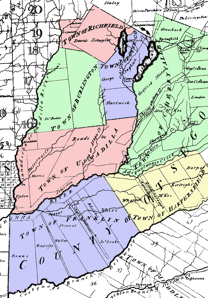
Map of Otsego County, New York c. 1792. Note that the county was larger than it is now, but with fewer towns. This was taken from a larger map by surveyor general Simeon De Witt and colored by me.
The county's towns at the time included:
- Burlington
- Cherry Valley
- Franklin (now a part of Delaware County, New York)
- Harpersfield (now a part of Delaware County, New York)
- Otsego
- Richfield
- Unadilla
Licensing
|
This work is in the public domain in its country of origin and other countries and areas where the copyright term is the author's life plus 70 years or fewer. | |
| This file has been identified as being free of known restrictions under copyright law, including all related and neighboring rights. | |
File history
Click on a date/time to view the file as it appeared at that time.
| Date/Time | Thumbnail | Dimensions | User | Comment | |
|---|---|---|---|---|---|
| current | 02:32, 19 June 2006 | | 729 × 1,044 (431 KB) | Nonenmac | Map of Otsego County, New York c. 1792. Note that the county was larger than it is now, but with fewer towns. This was taken from a larger map by Simeon De Witt. The county's towns at the time included: *Burlington *[ |
File usage
There are no pages that use this file.
Global file usage
The following other wikis use this file:
- Usage on ar.wikipedia.org
- Usage on bg.wikipedia.org
- Usage on en.wikipedia.org
- Usage on ja.wikipedia.org
- Usage on la.wikipedia.org
- Usage on nl.wikipedia.org
- Usage on pt.wikipedia.org