cal current over the polar, varies with the seasons and local circumstances. In winter the slope between the two currents is very gradual, as there is less difference of temperature, and less power of resistance between them. The warm current passes over the cold at a gentle inclination (as represented by the line B H in Fig. 1); and thus the horizontal or geographical extent of the storm beneath it—from B to D—which is the region of low barometer, is much enlarged, and sometimes its oscillations extend or move over several hundred miles.
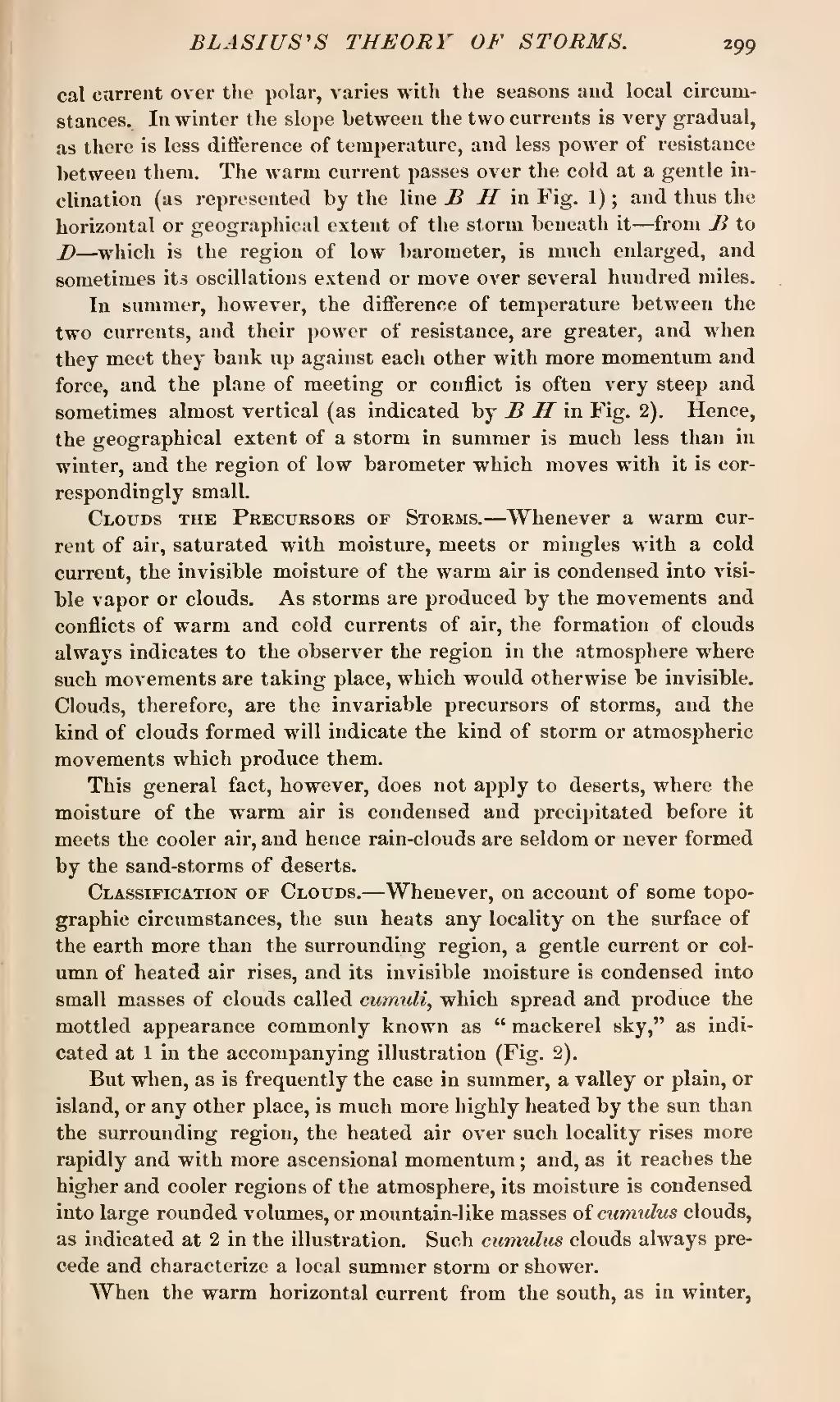
In summer, however, the difference of temperature between the two currents, and their power of resistance, are greater, and when they meet they bank up against each other with more momentum and force, and the plane of meeting or conflict is often very steep and sometimes almost vertical (as indicated by B H in Fig. 2). Hence, the geographical extent of a storm in summer is much less than in winter, and the region of low barometer which moves with it is correspondingly small.
Clouds the Precursors of Storms.—Whenever a warm current of air, saturated with moisture, meets or mingles with a cold current, the invisible moisture of the warm air is condensed into visible vapor or clouds. As storms are produced by the movements and conflicts of warm and cold currents of air, the formation of clouds always indicates to the observer the region in the atmosphere where such movements are taking place, which would otherwise be invisible. Clouds, therefore, are the invariable precursors of storms, and the kind of clouds formed will indicate the kind of storm or atmospheric movements which produce them.
This general fact, however, does not apply to deserts, where the moisture of the warm air is condensed and precipitated before it meets the cooler air, and hence rain-clouds are seldom or never formed by the sand-storms of deserts.
Classification of Clouds.—Whenever, on account of some topographic circumstances, the sun heats any locality on the surface of the earth more than the surrounding region, a gentle current or column of heated air rises, and its invisible moisture is condensed into small masses of clouds called cumuli, which spread and produce the mottled appearance commonly known as "mackerel sky," as indicated at 1 in the accompanying illustration (Fig. 2).
But when, as is frequently the case in summer, a valley or plain, or island, or any other place, is much more highly heated by the sun than the surrounding region, the heated air over such locality rises more rapidly and with more ascensional momentum; and, as it reaches the higher and cooler regions of the atmosphere, its moisture is condensed into large rounded volumes, or mountain-like masses of cumulus clouds, as indicated at 2 in the illustration. Such cumulus clouds always precede and characterize a local summer storm or shower.
When the warm horizontal current from the south, as in winter,