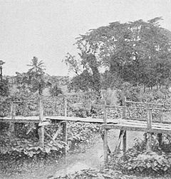
radii from a centre. The centre itself is a wide expanse of waters interspersed with numerous wooded islands. The surrounding country consists generally of woody hills, frequently crowned with white temples. In the distance are to be seen the high mountains of Zingai and in favourable weather the more distant and lofty ones which separate Martaban from the countries of Lao and Siam.[1]
Moulmein, the headquarters of the Division, is one of the chief ports of the province. North of Amherst is Thatôn, a plain country intersected by ranges of hills and half covered by forests.
Salween is a maze of mountains and woods, and so is Karenni, but with a well-watered plain in the north-west. The part of Toungoo, east of the Sittang, which completes this section, is also a hill tract.
Arakan. (3) The western part of Lower Burma is the Arakan Division including administratively the Hill District of northern Arakan which is geographically part of the Chin Hills. The rest of the Division lies between the Arakan Yoma and the Bay of Bengal. Arakan was annexed at the same time as Tenasserim (1826). Bordering on Chittagong on the north, it has usually been more readily subject to Indian influence than other parts of the Province. Embracing the districts of Sandoway, Kyaukpyu and Akyab, the Division consists of a strip of level country along the coast, broadening out to a wide plain in the north. Spurs of the Yoma fill the inland area extending nearly to the sea in the two southern districts. In the south is a rock-bound shore; further north
- ↑ Crawfurd, 361.

