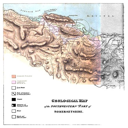
IX. Sketch of the Geology of the South-Western Part of Somersetshire.
By LEONARD HORNER, Esq. F.R.S.
§ 1. I beg leave to offer to the Society an account of some observations
on the mineralogy of that part of Somersetshire which
lies on the Bristol Channel westward of the river Parret. The shortness
of my stay in the country prevented me from conducting my
examination with that minuteness of detail which an accurate
survey should possess, but I trust that with the assistance of the accompanying
map[1] and the series of specimens which I have deposited
in the museum of the Society, the following notes will be sufficiently
distinct to afford a general view of the geological structure of that part
of England. I have distinguished in the map, by means of different
colours, the situation which the several rocks occupy, and although,
from unavoidable sources of error, the boundaries of each can
only be considered as approximations to the truth, yet I do not
conceive that the inaccuracy in that respect is so great as to affect
any geological deductions.
§ 2. In the western part of Somersetshire, and partly within the adjoining county of Devon, there is a large district of high land, the greater part wild and uncultivated, extending about 30 miles from east to west, and about 16 miles between north and
- ↑ Pl. 23

