Maury's New Elements of Geography for Primary and Intermediate Classes/Europe
EUROPE.
LESSON LI.
1. Europe.—Columbus sailed westward and found the New World; let us sail eastward and visit the Old World. Europe shall be our first landing-place. It is only a little larger than the United States, and so is one of the smallest of the continents.

The Monastery of St. Bernard.
Still it has a far larger population than any other continent except Asia. It is very much more thickly settled than the United States, and thousands of people come every year from its crowded countries to find new homes with us.
2. Seas, Bays and Gulfs.—The first thing that attracts the eye of a sailor as his vessel approaches the land, is the coast. That of Europe is remarkably well provided with safe harbors. Look at the map. See how jagged, or as we say indented, the coast line is. Everywhere we find seas, bays and gulfs.

Central plateau, Germany.—The falls of the Rhine, St. Goar.
It is no wonder that Europe, having so many harbors, sends out more ships and has more commerce than any other part of the world.

Southern mountains.—The Alps, Switzerland. Notice great glacier.
3. The Surface of Europe may be divided into two parts, the one a vast plain in the northeast; the other a mountainous region in the southwest.
4. Mountains.— The Alps are the most celebrated mountains of Europe. Their loftiest peaks are always covered with snow. Many of the high valleys are filled with the wonderful ice-streams called glaciers. There are as many as four hundred. Some of them are twenty miles long and three miles broad.

Northern coastal plain, Netherlands. Notice flat country, canal, windmills.
Sometimes avalanches, or large masses of snow, break loose and slide down the mountain side with a terrific crash. Villages have been buried by them, and people crushed to death.
There are many natural roads, or passes, across the Alps. On one of them is the Monastery of St. Bernard. Here, amid everlasting winter, live some pious monks. They have taught the celebrated dogs of St. Bernard to hunt for persons who have lost their way in the snow. These animals are seat out during snowstorms, with baskets of food and wine tied round their necks, to relieve travelers who are perishing in the bitter cold.
Several tunnels have been cut through the Alps.
5. The Rivers of Europe are not so large as some of those in North and South America.
The Volga is the longest. It is noted for its fisheries. The Danube is navigable for the greatest distance. Thousands of vessels ply on its waters. The Rhine is the most famous for its scenery, its castled crags, and vine-clad banks.
6. Climate.—The most northern part of Europe lies near the North pole, and, like Alaska and Greenland, is very cold. But most of Europe is in the Temperate zone, and has a mild climate.

A branch of the olive tree with ripe fruit.
In the most southerly parts people do not even build chimneys to their houses, because it is rarely cold enough for fires. The climate is like that of Florida.

An old olive tree.
There is something very curious that we must notice about the climate of western Europe. There the winters are much warmer than they are on the opposite side of the ocean in North America. This is owing to the westerly sea-winds, which, blowing over the warm waters of the Atlantic ocean, carry warmth and moisture to the land. Hence, the winters are far milder than ours.
London is several hundred miles farther north than Quebec, in Canada. At Quebec there is sleighing for half the year; in London a sleigh-bell is never heard.
7. The productions of northern Europe are like those of the cold countries of North America. On the shores of the Arctic ocean, vegetation is scanty and trees are stunted. In the middle portion of the continent we find a rich agricultural region, like our great Mississippi valley. Wheat and rye are raised in immense quantities. Hemp is grown to make rope for Europe's fleets of ships, flax for the manufacture of linen, and beets for the making of sugar. The warm hillsides are covered with vines, and the best of wine is made.

Silkworm, cool and moth. (Half their natural size.)
Southern Europe is one of the greatest fruit-growing regions in the world. Grapes, oranges, lemons, figs, and olives grow in rich profusion. Vast fields are covered with mulberry-trees, on the leaves of which the silkworm is fed.
The silkworm spins about himself a little house of yellow silk, called a cocoon, to sleep in while he is a chrysalis. This silk house is like a little egg, about an inch long. When the chrysa1is is ready to use his wings and live as a moth, he bursts through the silken walls of his house and flies out. But this, of course, breaks the silk all to pieces.
So the silk-grower puts the cocoon into hot water, kills the chrysalis, and saves the silk.

A pile of silk cocoons.
For Recitation.—How does Europe compare with the other continents in size and population? What is remarkable about the coast of Europe? Describe the surface of Europe. Which are the most celebrated mountains of Europe, and for what are they noted? What are the chief rivers of Europe? How does the climate of Europe compare with that of North America? What are the chief products of northern Europe? Of middle Europe? Of southern Europe? What can you tell about the silkworm?

MAP STUDIES.
Of what countries are the following cities the Capitals?
| London, | Paris, |
| Berlin, | St. Petersburg, |
| Vienna, | Rome, |
| Madrid, | Lisbon, |
| Constantinople, | Brussels, |
| The Hague (haig), | Copenhagen, |
| Athens, | Berne, |
| Bukharest (see map), | Belgrade. |
What ocean is north of Europe? What ocean is west? What sea, river, and mountains form the eastern boundary? What sea is on the south?
What countries in Europe border on the Mediterranean sea? Which border on the Atlantic ocean? Which border on the Baltic sea? Which have no seacoast?
What part of Europe is nearest to Africa? In what direction is Europe from Africa?
What two countries in the northwest of Europe together form a peninsula? What sea and gulf are east of Sweden?
Through what strait can vessels sail in going from the North sea into the Baltic? Rack means strait.
Where is North cape? What mountains are in Norway? What islands are off the west coast? These islands are noted for their fisheries.
Which is the largest country of Europe? What mountains are on the northeast border of Russia? What mountains are on the south? What seas are on the south? What sea on the coast of Russia is a part of the Arctic ocean?
What large river flows into the Caspian sea? What river flows into the Sea of Azof? What large river flows into the Black sea? (Pronounced nee'-per.)
In what general direction do all these rivers flow? What river flows into the White sea? In what direction? In what part of the country is St. Petersburg? Moscow? Odessa? Archangel? On what river is Nizhni Novgorod (nizh'-ne nov'-go-rod)?
In what direction would you go from St. Petersburg to Berlin? On what waters would you sail in going from Odessa to Vienna? Odessa to England?
Where is Denmark? What seas and strait nearly surround it? What Danish island is the nearest part of North America to Europe?
Copenhagen is on two islands.
What country is south of Denmark? What country bounds the German Empire on the east? What two countries bound it on the south? What countries bound it on the west?
On what two seas does Germany border? What rivers cross it? Into what seas do they flow? On what river is the chief seaport?
Where are the Netherlands and Belgium? What country is south of England? What bay is west of France? What strait separates France from England? What sea is south of France?
On what river is Paris? What important seaport on the Mediterranean? (Pronounced mar-saylz'.) Corsica, an island that belongs to France, in the Mediterranean, was the birthplace of Napoleon the Great.
What little country is south of Germany? What celebrated mountains are in Switzerland? If you go eastward out of Switzerland, what country do you enter? On what sea does it border? What port has Austria on the sea? (Pronounced tre-est'.)
What two large countries border Austria on the north? What mountains are in the east?
What great river crosses the country? Into what sea does it flow? What capital is on the Danube?
What three little countries border on the Danube? Where is Montenegro?
What mountains separate Bulgaria from Turkey? What sea is on the east of Turkey? What sea is on the west?
Where is the Sea of Marmora? In what direction is St. Petersburg from Constantinople?
Use the scale of miles and measure the distance between them. What country is south of Turkey?
Archipelago is the name given to the sea east of Greece. It is dotted with islands.
What large island is south of the Archipeloga? Where are the Ionian islands?
What country is west of the Adriatic sea? What natural division of land is Italy? What is its shape? What two large islands belong to Italy?
What mountains are in Italy? What river is in the north? Where are the volcanoes Mt. Vesuvius and Mt. Etna? What strait is between Sicily and Italy? Where is Venice? Naples?
In what direction is Berlin from Rome? Rome from Paris? Use scale and tell how far apart these cities are.
What two countries in the southwest of Europe form a peninsula? What mountains separate Spain from France? What ocean is west of the peninsula?
What sea is east? What strait unites these waters? What bay is north of Spain?
What two capes are on the coast? In what part of the country is Madrid?
Map Drawing.—The easiest portion of Europe to draw is the peninsula of Spain and Portugal. Have the pupils draw this. Name the bounding waters and the rivers, and locate the capitals.
On an outline map of Europe, write in the names of the surrounding waters, the seas, gulfs, bays, and straits. Next the names of mountains, rivers, lakes, and countries may be neatly printed in. Capital cities may be properly represented. Several lessons may be profitably given to the development of such a map. THE BRITISH ISLES.
LESSON LII.
1. The British Isles are also called the United Kingdom of Great Britain and Ireland. They consist of two large islands, Great Britain and Ireland, and a number of smaller ones.

Windsor Castle, the residence of the King of England.
Great Britain contains England, Scotland, and Wales. It is only a little larger than the state of Kansas, yet the king of this island rules one-fourth of all the land, and more than one-fourth of all the people, of the world. His subjects are found on every continent, and the sun is always shining on the British flag.

Country homes in England.
Great Britain is noted as a manufacturing country. She owns more ships, and carries on more commerce, than any other nation.
Her trade with the United States is immense. She buys our grain, pork, and beef to feed her crowded millions; and we buy her manufactured goods. She is our best customer.
England is dotted with cities and towns.
London is the largest and richest city in the world, and the first in commercial importance. It is the capital of the British empire, which includes lands and people in every part of the world. It is on both sides of the river Thames (temz). More people live in London than in the whole state of Ohio.

A residence in London.
Liverpool is one of the great commercial cities of the world. It is famed for its docks. A great part of our cotton, wheat, beef, and pork that go to England is landed there.
The reason for this is that Liverpool is the seaport that is nearest to the large cities in the north of England, where there are hundreds of factories to supply with raw cotton and millions of people to supply with food. London and Liverpool together have more than two-thirds of the entire trade of the country.
Leeds is noted for woolens as well as for iron and steel goods.

London Bridge. This is the oldest of the many bridges that cross the Thames and connect the two parts of the city. There are also three tunnels under the river.
Birmingham is fairly for its coal mines and iron manufactures; Sheffield for cutlery; Newcastle is in the coal regions and is noted for shipbuilding and for its coal trade.
Manchester is celebrated for cotton goods.
This city is connected with the river Mersey by a ship canal, so that ocean steamers from America, laden with cotton, grain, and cattle, can unload at her docks.
All the large manufacturing cities of Great Britain are in or near the coal mining regions. Much coal is needed to feed the boilers that make steam to run the machinery. Many of these cities grew up before there were any railroads.
-
 Edinburgh, the old capital of Scotland.
 -
 Custom House, Dublin, Ireland.
 -
 A group of Welsh ladies.


2. Scotland is a hilly country, noted for the beautiful scenery of its lakes and mountains.
Edinburgh (ed'-in-bur-ruh), the ancient capital, is famed for its university. Glasgow is the largest city. It is built along the river Clyde, where there are large shipyards. Engines, boilers, and many kinds of machines are made here. .
3. Wales is a very mountainous country. It has rich mines of copper, coal, and iron.
4. Ireland, the green or “Emerald Isle,” is the home of the Irish people. Dublin is its chief city. Belfast is noted for the making of linen. Many Irish people have come to our country and are among its most useful and valued citizens.
For Recitation.— Of what do the British Isles consist? What is said of the manufactures and commerce of England? What can you say of London? Name several other important cities. What can you say of Scotland? Name the chief cities of Scotland. What are the chief cities of Ireland?

MAP STUDIES.
What ocean is west of the British Isles? What channel and strait is between England and France? What sea and channels separate England from Ireland? What hills are between England and Scotland? In what direction is Ireland from England? Scotland from England? Where is Wales? Where are are the Hebrides (heb'-rid-eez)? The Orkney and Shetland Isles? Where are the Grampian Hills?
The bays on the coast of Scotland are called firths. Name two on the east coast. What is the capital of England? On what river is it? Where is Liverpool? Birmingham? Manchester? Sheffield?
Where is Edinburgh? In what direction is it from London? Where is Glasgow? Dublin? Belfast? LESSON LIII.
1. Northern Europe.—The cold countries of Europe are Sweden, Norway, and Russia.
2. Sweden and Norway together occupy a peninsula in the northwest of Europe. They used to be both governed by one king, but each now has its own king. Except in the southern part, Sweden is mostly mountainous and rocky. Its chief wealth is in its mines, forests, and fisheries. Swedish iron is the best in the world. Stockholm is the capital of Sweden; Christiania, of Norway.

Drying fish on the coast of Norway.
3. Russia (rush'a) is the largest country in Europe. It covers more than half the continent.

Sleighing in a Russian village.
It extends from the cold shores of the Arctic ocean to the warm lands on the Black sea. It has, therefore, a great variety of climate.
The southern half is like our prairie region. It is one of the great wheat-growing countries of the world. Immense crops of hemp and flax also are grown, and vast herds of cattle are raised.
The leading exports are grain, hides, and tallow. Odessa is the chief grain port.
A great deal of the trade of Russia is carried on at fairs. These are great gatherings of buyers and sellers of all kinds of goods.
The largest fair in all the world is held at Nizhni Novgorod (nizh'ne nov'-go-rod). Here we may see 5,000
STUDIES ON THE RELIEF MAP.
Highlands and Lowlands.—The surface of Europe, like that of North America and of South America, is composed of several highland regions bordering a Great Central plain. Find the Great Central highland region of Europe. In which directions does it extend? What is it called? Find the sources of four rivers in this region. Trace the one flowing north. The two flowing east. The one flowing south. Find the highland region northeast of the Alps. What is its name? What highland region southeast? What kind of surface have the peninsulas in the south of Europe? Find the highland region separating France and Spain. In what directions does it extend? Trace the highland region extending from the Black to the Caspian sea. What is its name? Trace the dividing highlands between Europe and Asia. These mountains form the natural boundary of the two continents. What is their name? Direction? Truce the highlands in the northwestern part of Europe.
Coast.—Trace the coast line of this section. What can you say of it? Name five of the great inlets on this coast. How does it compare with the southern coast? What other continent has a very irregular coast line? Now look at the Great Central plain. Find a place in it that seems to be the source of rivers. This high region is in the central part of Russia. Locate this place on the political map a little west of the city of Moscow. Four great rivers rise in this section. Trace these rivers and give their names. Find the body of water into which each one flows. In what parts of the continent do you find a great number of islands? Notice that these sections are mountainous. The islands seem to be the tops of mountains that project above the water. Notice that the mountainous coasts have also the greatest number of good harbors.
Climate.—Trace the part of Europe that is in the cold zone. What part of it is in the Temperate zone? What kind of plants are found in the southern part? (See lesson LI.) Find the portion where the vine grows. Find the grain-raising section. The western coast of Europe has a mild climate. What is the reason for this? The parts bordering on the Mediterranean also are very mild because the mountains shut off the cold winds from the north. The parts of the Great Central plain bordering on the Black sea are not protected in this way, and hence have a very cold climate in winter. Find these portions. These studies may be continued further at the discretion of the teacher.

Use this map as suggested in the studies on the opposite page.
4. Russia is an empire. The ruler is called the Czar (zar).
St. Petersburg, the capital, is his home. It is a city of palaces and line buildings.
Moscow is a splendid old city, full of churches with gilded domes and spires, from which on holidays the peals of a thousand bells ring forth.

View in Moscow, the old capital of Russia. The group of buildings is called the "Kremlin",
a word meaning fort or citadel. It contains the royal palaces, cathedrals, churches, and an arsenal.
5. Lapland is a cold, desolate region bordering on the Arctic ocean. It is the home of the Lapps, a people like our Eskimos.
The warm weather in Lapland lasts for only two months in the year. The long winters are made a little more cheerful by the aurora, which often tills the sky with long, waving streamers of white, green, and crimson light.
The Lapps make much use of the reindeer. This animal supplies them with milk and cheese. It will pull a sleigh a hundred miles a day. Its flesh is the only meat of the Laplanders. Its skin is made into coats, caps, and boots.

Lapps and their homes. The tents are made of reindeer hides stretched on poles.
For Recitation.—What countries are in Northern Europe? What can you say of Sweden and Norway? What are the chief occupations in Sweden and Norway? What can you say of the size of Russia? What are the great productions of Russia? In what way is the commerce of Russia largely carried on? What are the chief cities of Russia? What do you know of Lapland?
HOMES AND PEOPLE.
At the top of the opposite page five pictures of people who live in the northern part of Europe. Find the country of the Laplanders on the relief map. Like the Eskimos, they belong to the Yellow race. Their houses are made of stones and earth and sometimes of skins stretched upon poles. You may see one of these huts in the picture. Their chief wealth is the reindeer, and nearly every Lapp has a herd of his own. The people live on reindeer meat and milk, and their clothing is made of reindeer hides. You see that the reindeer is harnessed to a kind of sled. He is a very swift animal and the Laplanders make long journeys in reindeer sledges.
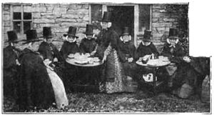
The girl that you see in the second picture lives in a cottage in one of the high valleys of Switzerland. Notice how the cottages are built with a protected veranda on each floor. The staircase leads to one of these outside porches. The view in the upper right-hand corner shows some Russian peasants taking tea outside of their house on an afternoon in summer. On the table is the large samovar, or urn, from which the tea is poured. The Russians are great tea-drinkers and buy more tea in China than any other nation.
The next picture shows a girl peddling milk in a town in Belgium. In that country dogs are more commonly used than horses to draw light loads. The officer is testing the milk to see whether it is pure. What country has many canals and windmills? Can you tell what each is used for? The windmills furnish power to grind grain as well as to keep the country drained by pumping the water out of the canals.
In the lower part of the picture is a party of Spanish musicians in a garden. These people are very fond of music and dancing, and the most of the houses are built with a little court, or enclosed lawn, where they can be cool and comfortable during the hot afternoons of summer. The long and narrow street is in Italy in the city of Naples. Do you think that there are any street cars or wagons passing through this street? Notice the tall houses with overhanging balconies and windows. Each one of these houses contains homes for very many families.
The last picture shows a street in Constantinople. What can you tell about the situation of this city? Most of the shops or bazaars of Constantinople are in the street. Fruits and vegetables are brought into the city in great baskets slung in pairs across the backs of donkeys. They are then peddled through the streets or placed on stands to be sold. On the left of the picture you can see a street. How very narrow it is. Hardly wide enough for the people; of course there is no room for wagons, but the little donkey can easily go through with his load. The windows of the living rooms of the house are covered with a close latticework so that no one can see through them from the outside. 
Home and People of Europe. Study these pictures in connection with the descriptions and questions on the opposite page.
LESSON LIV.
1. In Central Europe we find the German empire, the Netherlands (also called Holland), Denmark, Belgium, France, Austria, and Switzerland.

A dog team in Brussels.
2. The German Empire contains twenty-six different states, of which Prussia is the most important. They are united under one government, and are often called Germany.
The country is rich in minerals of many kinds. A curious product is amber, which is gathered on the shores of the Baltic sea.
Grain is raised in large quantities, Rye is the grain most grown. Many cattle, sheep, and hogs are raised.
The valleys of the Rhine and other rivers are
Homes in Nuremberg Germany.
famed for their grapes. The slopes of these valleys are covered with vines, each fastened to a stake, to support its clusters of fruit. It is a merry time in the vineyards when the ripe grapes are gathered. The wines are celebrated.
In the summer vast fields are to be seen blue with the flower of the flax, and tier many is one of the great linen-making countries of the world. The sugar-beet is widely grown, and a large quantity of sugar is made. From the sheep of Germany the finest wool is obtained.
Many of the toys that Santa Claus brings at Christmas are made in this country. In some of the cities hundreds of the people are employed in making them.
No people in Europe are better educated than the Germans. They are great lovers of music.
Berlin, the capital, is one of the finest cities on the continent. Hamburg is one of the great commercial cities of the world.
3. The Netherlands.—We come now to one of the strangest of all countries, the Netherlands or Holland.
The name means low countries, and low they are. In some places the land is twenty or thirty feet below the surface of the sea. Great embankments of earth, called dykes, have been built to keep out the water. They are like our Mississippi levees.
We see the great white sails of windmills all over the country. What does it mean? Some of these mills are grinding wheat, but most of them are pumping the Netherlands dry.
In this watery land there are a great many canals. They cross the country in every direction and serve instead of roads.
In winter they are, frozen over, and all the people go about on skates and sleds. The women often skate several miles to market, with baskets of eggs on their heads.
The Dutch (as the people of the Netherlands are called) are great cattle-raisers, sailors, and fishermen. They are a most enterprising people, and have a large foreign commerce.
The Hague is the capital.
View in the city of Rotterdam, showing canal and bridge. Notice the steep roofs and high gables of the houses
Many of the people are engaged in fishing.
Copenhagen, the capital, is a handsome city.
5. Belgium is one of the smallest countries in Europe, but it is the most thickly peopled of the European countries.
The people are as busy as bees, and they cultivate their farms as carefully as gardens, and are very skillful manufacturers. They have some of the greatest iron works in the world. Many of the women are lacemakers. Some of the lace that they make is worth as much as $250 a yard.
Brussels is the capital. It is a gay city, and for this reason is sometimes called Little Paris.
6. France is a beautiful country. The people are remarkably industrious and economical. Like the Belgians, they are busy farmers and manufacturers.

A vineyard scene in France.
Northern France produces grain and root crops. Immense quantities of beets are grown for making sugar.
Middle France is a great vineyard.
It is interesting to be there in the merry season when the grapes are gathered. The ripe clusters are picked by men, women, and children, and carted to great vats, where the juice is pressed out and allowed to stand until it ferments and becomes wine. The wines of France are sold all over the world and yield a very large amount of money.
In Southern France, which borders on the warm Mediterranean, we find many of the people occupied in raising silk-worms, and making olive oil, or pickling olives for export.


A chateau, the country home of a nobleman in France, and a residence
street in Paris, showing apartments or "flats," in
which most of the people of Paris live.
The chief manufactures of France are silk goods. The silk factories of Lyons are the most important in the world. They employ one hundred thousand persons.
France is a republic. Paris, the capital, is the most splendid city of Europe.
It is noted for the manufacture of articles requiring taste and delicate workmanship. Its porcelain, jewelry, instruments, and kid gloves are famous.
Marseilles has a larger commerce than any other port of France.

Vienna, the capital of Austria.
7. Austria-Hungary is one of the empires of Europe. It contains the two states, Austria and Hungary, under one emperor.
Austria-Hungary is one of the richest mineral regions of the continent. Its salt mines are the largest in the world.
The chief agricultural products are wine, grain, hemp, and flax. Hungary is noted for its wines.
The most important manufactures are linen goods and colored glass.

A street in Berne showing the clock-tower, beneath which is one of the gates of the city.
Vienna, the capital of the empire, and Budapest, the capital of Hungary, are the largest cities.
8. Switzerland.—This little republic is nestled among the Alps. It is famous for its grand mountain peaks and beautiful lakes. So many people go there every year to enjoy the scenery that it is called the playground of Europe.
Most of the Swiss are occupied in the care of sheep and cattle. They are also celebrated for the manufacture of watches and cotton goods.
Berne is the capital.
For Recitation.—What countries are in Central Europe? Name the chief products of Germany. For what are the Germans noted? What is remarkable about a large part of the surface of the Netherlands? What are the chief occupations in the Netherlands? What are the chief occupations in Denmark? For what is Belgium noted? What are the chief occupations in France? What are the chief products of France? What are the chief manufactures of France? For what is Austria-Hungary noted? What are the chief occupations of the Swiss?

Thun, a picturesque town among the Alps in Switzerland. The church which you see in the picture is more than 700 years old.
LESSON LV.
1. Southern Europe consists of Spain and Portugal, Italy, Greece, Turkey, Rou-ma'-nia (roo-), Servia, Bulgaria, and Mon-te-ne'-gro.
2. Spain and Portugal were once the foremost countries of Europe. They occupy a peninsula. A large part of the country is mountainous. Spain is a kingdom, and Portugal is now a republic.

Home of a Spanish nobleman. Notice the flowers in the open court, or patio, and the palace around it. Compare with the patio on page 78.
From the top of the loftiest mountains the view is beautiful. We see the blue Mediterranean like a quiet lake, dotted with steamers and white-sailed vessels. Snowy mountain peaks are all around us, and far away over the water is the dim outline of the shores of Africa.
Spain possesses the richest quicksilver mine in the world. Among the highlands are raised large flocks of merino sheep, so famed for their wool. In the valleys fine crops of wheat and corn grow.
The southern portion of the peninsula is a land of fruits. Grapes and figs, lemons and oranges grow in profusion. The wines are among the most celebrated in the world.
From Spain we get sherry; from Portugal, port wine; and from both, raisins and other fruits, and cork.
Cork is the bark of the tree called the cork-oak. Large forests of this oak grow in Spain and Portugal.
Madrid is the capital and largest city of Spain; Lisbon, of Portugal.
3.Italy is a peninsula, and, as we see on the map, has the shape of a boot. The Apennine mountains stretch through it from top to toe.
Sicily and Sardinia belong to Italy.
No country in the world is more famed than Italy for its beautiful scenery, its sunny skies, and its delightful climate.
The agricultural products are like those of Spain. Immense plantations of mulberry-trees are grown, and more silk is produced here than in any other country of Europe. Here, too, are the largest rice fields on the continent.

Palaces where people live and canals which serve for streets in Venice. The boat which we see is a gondola.

The cathedral at Seville.
Among the mineral products we must remember sulphur. The chief supply of the world comes from Italy. It is used in making gunpowder.
4.Rome is the capital. In ancient times this city ruled the world. In Rome is St. Peter's, the largest church ever built. Naples is built round the shores of a beautiful bay.
In sight of Naples is the volcano, Vesuvius. An eruption about 1800 years ago buried three cities in ashes and lava.
Venice is a curious city built on numerous islands several miles from the mainland. It has canals instead of streets, and boats instead of carriages. Beautiful glassware, jewelry and lace are made in this city.
5. Greece was the most cultivated nation of ancient times. Athens is the capital. The Greeks wrote the best poetry, painted the finest pictures, and erected the handsomest buildings. Many

Gathering oranges near Valencia in Spain.
remains of these still exist: but the glory of Greece has passed away. Still the country is far better off than it was some time ago. There are now good roads; you can travel by rail, and send a telegram if you wish, and everybody can get a public school education.
The only export that deserves to be mentioned is currants, which are a kind of little grape.
6. Turkey is an empire consisting of many different parts. It is like a body, the head of which is in Europe, the other parts elsewhere.
Turkey is, perhaps, the worst governed country in the world, but the people now have some share in the government. The Emperor is called the Sultan. The land is fertile, but the farming is wretched. In fact, scarcely anything is well done in all the country.

A spice shop in the streets of Constantinople.
Two good things, however, are made: carpets and at'-tar of roses—a perfume made from rose leaves. Near the cities where this perfume is made, whole fields are planted with rose trees.
The Turks are Mohammedans. They worship God, but they do not consider the Bible as his word. Instead of it they have the Koran, a book written by Mohammed, whom they call "The Prophet." Their churches are called mosques (mosks). Friday is their Sunday.
Con-stan-ti-no'-ple, the capital, is one of the most beautiful cities in the world.
7. The Kingdoms of Bulgaria, Servia, Roumania, and Montenegro were formerly parts of the Empire of Turkey. Bulgaria was the last of these states to become entirely independent of Turkish rule.
These four countries and Turkey occupy a region called the Balkan peninsula. Roumania and Bulgaria are in the fertile valley of the Danube river; Servia and Bulgaria are more mountainous. Servia has no seacoast.
The chief products are grain, hogs, and cattle.

Ruin of ancient buildings in Athens. The hill in the background was the
Acropolis, or citadel, of the town. On its summit was the Parthenon, or
Temple of Minerva, the most beautiful building in the world.
For Recitation.—Of what does Southern Europe consist? What are the chief exports of Spain and Portugal? For what is Italy noted? What can you say of Greece? Name two of the leading manufactures of Turkey. What are the chief products of Roumania, Servia, and Bulgaria?
REVIEW OF EUROPE.
Countries.—In what part of the continent is it? Name the capital.—Sweden. Norway. Great Britain. Netherlands. Germany. Denmark. Russia. France. Belgium. Switzerland. Austria-Hungary. Turkey. Servia. Roumania. Greece. Italy. Spain. Portugal.
Islands.—Near what port of the coast? To what country does it belong?—Ireland. Hebrides. Orkneys. Shetland Isles. Sicily. Sardinia. Corsica. Crete.
Capes.—On what part of the coast?—North. Matapan. St. Vincent. Finisterre (-tair).
Mountains.—Where are they, and in what direction do the ranges extend?—Alps. Caucasus. Ural. Apennines. Pyrenees. Balkan. Carpathian. Doverfield. Mt. Etna. Mt. Vesuvius.
Bay, Gulf, and Seas.—Where is it?—Bay of Biscay. Gulf of Bothnia. Mediterranean Sea. Black Sea. Baltic. Adriatic. North Sea. White. Irish.
Straits.—Connects what waters? Separates what lands?—Gibraltar. Dover. Messina.
Rivers.—Where does it rise? Into what does it flow?—Volga. Danube. Dnieper. Don. Dwina. Vistula. Oder. Elbe. Rhine. Rhone. Po. Seine. Tagus. Loire (lwar).
Lakes.—Where is it?—La-do'-ga. O-ne'-ga. Caspian Sea.
Cities.—In what country? On or near what water? —Liverpool, Edinburgh. Lyons. Hamburg. Dresden. Moscow. Odessa. Dublin. Naples. Venice. Marseilles. Trieste. Nizhni Novgorod.