Rude Stone Monuments in All Countries/Chapter 8
CHAPTER VIII.
FRANCE.
It is only in very recent times that the French have turned their attention to the study of their Rude-Stone Monuments; but since they have done so, it has been in so systematic and scientific a manner that, had it been continued a few years longer, little would have been left to be desired by the students of that class of antiquities in France. War and revolution, however, intervened just as the results of these labours were about to be given to the world, and how long we may now have to wait for them, no one can tell. The Musée de St.-Germain was far from being complete in July last, and only the first parts of the great 'Dictionnaire des Antiquités celtiques' had been published at that time. We can now hardly hope that the necessary expenditure will be continued which is indispensable to complete the former, and it is difficult to foresee in what manner the materials collected for the dictionary can now be utilised.
Even when much further advanced towards completion, it is hardly to be expected that the museums of St.-Germain and Vannes can rival the royal collections at Copenhagen; and if the French had confined themselves only to collecting, they would not have advanced our knowledge very much; but, while doing this, they have also gathered statistical information, and have been mapping and describing, so that our knowledge of their monuments is much more complete than of those of the Danes. To borrow a simile from kindred sciences, it is as if the Danes had attended exclusively to the mineralogy of the subject: collecting specimens from all parts, and arranging them according to their similarities or affinities, wholly irrespective of the localities from which they came. The French, on the other hand, have founded a science similar to that of geology on their knowledge of the minerals; they have carefully noted the distribution of the various classes of monuments, and, so far as possible, ascertained their relative superposition. The first is, no doubt, a most useful process, and one that must to a certain extent precede the other; but unless we map the various rocks on the surface and ascertain their stratification, it hardly helps us in studying the formation or history of our globe.
In 1864 M. Bertrand published in the 'Revue archéologique' a small map of France, showing the distribution of dolmens as then known; and three years afterwards another, on a much larger scale, intended to accompany the 'Dictionnaire des Antiquités celtiques,' and containing all that was then known. Were a second edition of this map published now, it would, no doubt, be much more full and complete; but the main outlines must still be the same, and are sufficient for our present purposes. From these maps and the text which accompanies them we learn that the greater number of the rude-stone monuments in France are arranged at no great distance on either side of a straight line drawn from the shores of the Mediterranean, somewhere about Montpellier, to Morlaix, in Brittany. There are none east of the Rhone, none south of the Garonne, till we come to the Pyrenees, and so few north of the basin or valley of the Seine that they may be considered as wanderers.
Referring to the table at the end of this chapter, which is compiled from that of 1864, we find that thirty departments contain more than ten monuments. Thirty others, according to M. Bertrand, contain from one to eight or nine; and the remaining twenty-nine either contain none at all or these so insignificant as hardly to deserve attention.
From this table we learn, at least approximately, several facts of considerable interest to our investigation. The first is that, of the three divisions into which Cæsar divides Gaul, the northern in his day belonged to a race who who had no stone monuments. There are none in Belgium proper, and so few in French Flanders, or indeed in any part of Gallia Belgica, that we may safely assert that the Belgæ were not dolmen-builders. In the next place, I cannot help agreeing with M. Bertrand in his conclusion that the Celts properly so called have as little claim to the monuments as the Belgæ.[1] We know something of the provinces occupied by the Celts six hundred years before Christ from Livy's[2] description of the tribes who, under Bellevesus, invaded Italy. Their capital was Bruges, and they occupied the departments immediately around that city; but they had not then penetrated into Brittany, nor north of the Seine, nor into any part of Aquitania.[3] But they occupied the whole of the east of Gaul up, apparently, to the Rhine and the country on the east bank of the Rhone. According to the French statistics, there are 140,000 barrows or tumuli in the departments of the Côte-d'Or, Vosges, Haut-Rhin, Bas-Rhin, Doubs, Jura, and Ain, but not one single dolmen;[4] and there are none to the east of the Rhine. As we proceed westward, the tumuli become rarer, and the dolmens are gradually met with. The Averni, for instance, were one of the Celtic tribes that accompanied Bellovesus, and in their country dolmens are found; but perhaps we need only infer from this that in a hilly country like Auvergne the older people still remained, and followed their old customs in spite of its partial occupation by the conquering Celts. We do not know at what period the Celts first invaded Gaul, but there seems no reason for supposing that it could not be very long before they first came in contact with the Romans; and if we may judge from the rate of progress which they made in subduing the rest of the country in historic times, their first invasion could hardly have been a thousand years B.C. All the tumuli in the east of France which have been dug into have yielded implements of bronze and metal,[5] and if they belonged to the Celts, this would fairly accord with the conclusions at which archæologists have arrived from other sources with regard to the Bronze age. It is not, however, worth while following up the question here; for unless it could be proved that the dolmens either succeeded or preceded the tumuli, it has no bearing on our argument. The fact of their occupying different and distinct districts prevents any conclusion of the sort being arrived at from geographical or external considerations. Their contents, if compared, might afford some information, but up to the present time this has not been done, and all we can at present assume is that there were two contemporary civilizations, or barbarisms, co-existing simultaneously on the soil of France. My impression is, however, that the Celtic barrow-builders were earlier converts to Christianity, and left off their heathenish mode of burial long before the less easily converted dolmen-builders of the west ceased to erect their Rude-Stone Monuments.
We are thus reduced to the third of the great provinces into which Gaul was divided in Cæsar's time, to try and find the people who could have erected the stone monuments of France, and at first sight it seems extremely probable that they were erected by the Aquitanians. Both Cæsar[6] and Strabo[7] distinctly assert that the people of the southern province differed from the Celts in language and institutions as well as in features, and add that they resembled more the Iberians of Spain than their northern neighbours. When, however, we come to look more closely into the matter, we find that the Aquitania of Cæsar was confined to the country between the Garonne and the Pyrenees, and where, however, few, if any, dolmens now exist. They are rather frequent in the Pyrenees[8] and the Asturias, where remnants of the dolmen-building races may have found shelter and continued to exist after their congeners were swept from the plains; and there are one or two on the left bank of the Garonne, but except these there are none in Aquitania proper. If, however, we apply the term Aquitania to the province as extended by Augustus up to the left bank of the Loire, we include the greater part of the provinces where dolmens are found; but here again, when we look more closely into it, we find that the northern districts of this great province were, in Augustus' time, inhabited by Celts, or, at all events, that Celts formed the governing and influential bodies in the states. Indeed, the fact seems to be that, during the six centuries which elapsed between the invasions of Italy by the Gauls and the return invasion of Gaul by the Romans, the Celts had gradually extended themselves over the whole of central France from the Garonne to the Seine, and had obliterated the political status of the people who had previously occupied the country, though there is no reason to suppose they had then at least attempted to exterminate them. It must thus be either that the Celts were the builders of the dolmens, which appears most improbable, or that there existed in these provinces a prehistoric people to whom they must be ascribed.
Without at all wishing, at present at least, to insist upon it, I may here state that the impression on my mind is every day growing stronger that the dolmen-builders in France are the lineal descendants of the Cave men whose remains have recently been detected in such quantities on the banks of the Dordogne and other rivers in the south of France.[9] These remains are found in quantities in the Ardèche[10] and in Poitou.[11] If they have not been found in Brittany, it may be that they have not been looked for, or that the soil is unfavourable to their preservation; but they have been found in Picardy, though possibly not exactly of the same class. It is, of course, dangerous to found any argument on such local coincidence, as new discoveries may be made in the east of France or elsewhere; but in the present state of our knowledge the Cave men and the dolmens seem not only conterminous but their frequency seems generally to be coincident.
As we know next to nothing of the languages spoken in the south-west of France before the introduction of the Romance forms of speech, philology will hardly assist us in our enquiry. There is, however, one particle, ac, which I cannot help thinking may prove of importance, when its origin is ascertained. In the table at the end of this chapter, I have placed the number of the names of the cities having this termination in each department[12] next to M. Bertrand's number of dolmens. The coincidence is certainly remarkable, more especially as it is easy to account for the comparative paucity of names with this termination in Brittany by taking into account the enormous reflex wave of Celtic population from England that overwhelmed that country in the fourth and fifth centuries, and changed the nomenclature of half the places in the district: still, Carnac and Tumiac, Missilac, and others, as names of monuments, and Yffignac, as the name attached to the port which I believe was the place of embarkation for England, with many others that remain, are sufficient to attest that more previously may have existed.
The question remains, what is this particle? The first impulse is to assume that it is the Basque definite article. The Basques, for instance, say Guizon, "a man," Guizonac, "the man," and Guizónac, "the men," besides using it in other cases, while their local proximity to the dolmen country would render such a connection far from improbable. Against this, however, it may be urged, that ac, as a terminal syllable, hardly ever occurs in the Basque provinces, and the names to which it is attached in France hardly seem to belong to that language. Another suggestion has been made,[13] that it is equivalent to the Greek word πόις, which would be exactly the signification for which we are looking, though in what language this occurs is by no means clear. For our present purpose, however, it is of little consequence what it may or may not be. It is sufficient to know that its occurrence is, as nearly as may be, coincident with the existence of dolmens. It does not occur to the eastward of the Rhone, nor do dolmens, though both are frequent on the right bank of that river; and it is not to be found in the east of France, in those countries which we have reason to believe were at the dawn of history essentially Celtic, and where the tumuli of the Bronze period exist in such numbers. It does, however, occur in that part of Cornwall south of Redruth and west of Falmouth,[14] where all the rude-stone monuments of that province are found, but it is not found anywhere else in Great Britain or Ireland. Nor is it found in the Channel Islands, though dolmens abound there; but this may be accounted for by the subsequent colonisation of these islands, as of Brittany in more modern times, by races of a different origin, who have to a great extent obliterated the original nomenclature of the country.
Equally interesting, however, for our purposes is the fact that, though the ac-termination occurs frequently in the departments between the Garonne and the Pyrenees, no dolmens exist in that region except, as before mentioned, a few at the roots of the mountains. This, at first sight, might seem to militate against the universality of the theory; but I, on the other hand, only take it to express that the ac-people were driven from that country by Ibero-Aquitanians before they had adopted the fashion of stone monuments. If we knew when Aquitania was first occupied by the people whom Cæsar and Strabo found there, it would give us a date before which dolmens could hardly have existed; but as we have no materials for the purpose, all that can be said is that, just as the dolmen races were cut in two by the Belgæ before the use of stone for funereal monuments had been introduced, so here the same phenomenon occurred, and the people we have to deal with were driven north of the Garonne, west of the Rhone, and south of the Seine, before they took to building dolmens—assuming, of course, that they once had extended beyond those limits; but this, except in the case of Aquitania proper, does not at present seem capable of being proved.
Before the Romans came in contact with them, and our first written accounts describe them, they had ceased to be a nation politically, and their language also was lost, or, at least, except in the one syllable ac, we now know nothing of it. If, therefore, it may be argued, the nationality of this people was lost before the Christian era, and their language had become extinct, these monuments must belong to a long anterior period. There are, however, certain considerations which would make us pause before jumping too hastily to this conclusion. There are, throughout the whole dolmen region of the south of France, a series of churches whose style is quite distinct from that of central and northern France. The typical example of this style is the well-known church of St.-Front, Périgueux. But the churches at Cahors, at Souillac, at Moissac, Peaussac, Tremolac, St.-Avit-Sénieur, and many others, are equally characteristic. The cathedral at Angoulême, the abbey church at Fontevrault, and St.-Maurice at Angers,[15] and the church at Loches—all these churches are characterized by possessing domes, and the earlier ones by having pointed arches which look very much more as if they were derived from the horizontal arches of the tumuli than from the radiating arches of the Romans, which the Celts everywhere adopted; and, altogether, the style is so peculiar that no one the least familiar with it can ever mistake it for a Celtic style. All belong to the same group, and as distinctly as, or even more so than, the ac-termination, mark out the country as inhabited in the eleventh and twelfth centuries by a people differing from the Celts. Though, therefore, both their nationality and their language may have been superseded by those of the more enterprising and active Celts before the time of Cæsar, it is evident they retained their old feeling and a separate internal existence to a period at least a thousand years later.
There is still another trait that marks this country as a non-Celtic country in historical times—it is in the south-west, and there only, in France that Protestantism ever flourished or took root. To the Celt, the transition was everywhere easy from the government of the hierarchy of the Druids to that of the similarly organized priesthood of Rome. But it required all the cruel power of the Inquisition—the crusades of Simon de Montfort—the exterminating wars against the Camisards of the Cevennes—and, in fact, centuries of the most cruel and unrelenting persecution down to the revocation of the Edict of Nantes, and, indeed, to the French Revolution—to exterminate this people and extirpate the faith and feelings to which they clung. If they have in their veins, as I fancy they must have, any of the blood of the Cave people, they belong to one of the least progressive people of the earth, and we should not therefore be surprised if it required two thousand years of Celtic aggressiveness, coupled with Celtic ferocity, entirely to obliterate this race, if, indeed, that is done even now, which I very much doubt.
Before leaving this part of the subject, there is one other question which it may be as well to allude to here, as those investigations into the distribution of the rude-stone monuments seem destined to throw a new and important light upon it. Few questions have been more keenly debated among the learned than the relationship stated to have existed between the Cimbri and the Gauls. A great deal has been, and can be, said on both sides,[16] but the difficulty appears to me to have arisen principally from the erroneous assumption that no other people except the Celts existed in France.
There is no trace of Celts or of a Celtic language in the Cimbric Chersonese or the north-west corner of Europe, which is generally assumed to be the country occupied by the Cimbri, and no such people as the Cimbri are found settled in any part of France in historical times. If, however, we assume that the relationship may have been between the Cimbri and the Aquitanians, the case assumes a totally different aspect. As we do not know what the language of the Aquitanians really was, no assistance can be obtained from it, but our very ignorance of it leaves the field open for any other evidence that may be adduced, and that of the monuments seems clear and distinct. It seems almost impossible that there should be so much similarity between the monuments of the two countries without some community of race, and the great likeness that exists between those on the southern frontier of the northern dolmen province and those on the northern edge of the southern dolmen field seems almost to settle the question.
From history we only know of the existence of this relationship by the mode in which they fought together against Marius in the late Roman wars. If they were then geographically separated by the Belgæ and the Celts having thrust themselves between them, the separation must have been recent, for a barbarian people could hardly be brought to acknowledge the ties and duties of relationship after a long interval of time.[17]
As may be gathered from the table, page 376, or the map opposite page 324, the rude-stone monuments are pretty evenly distributed over the whole of the area extending from the English Channel to the Mediterranean Sea. Our knowledge of them is, however, practically confined to the northern portion of this zone, known as Brittany. The information which is available regarding those of Languedoc and Guienne is of the most meagre description. Hundreds of English tourists have visited Brittany, and many of them have drawn the monuments there and at least described them intelligibly; but I do not know one English book that mentions those in the departments of Lot or Dordogne, and almost the only information regarding them is to be picked up from the local "Statistiques;" but as these are very rarely illustrated, they do not suffice. No form of words will convey a correct idea of any unknown architectural monument except by comparing it with one that is known; and unless both have some well-defined features of style, it is even then very difficult, and with rude unshaped stones, almost impossible, by words to convey what is intended.
It is to be regretted that we do not know more of the southern examples,[18] as they are different in several essential features from those of the north; and it is probable that any one who was familiar with all could point out a gradation of style which would aid materially in determining their age. Whatever that may turn out eventually to be, no one will, I presume, contend that all are of one age or even of one century. It is far more probable that they extend over a considerable lapse of time, probably a thousand years, and if this is so, there must have been changes of fashion even among Cave races as their blood got more and more mixed; and it would be interesting to know where and—relatively at least—when this took place. My present impression is that the southern are the most modern, for this among other reasons.—I look on the sequence of a cist in a barrow to a dolmen or chamber in a tumulus as very nearly certain, and from that the sequence to the exposed free-standing dolmen, and from that to the dolmen on the tumulus, as nearly, if not quite as, probable. The latter form, so far as I know, never occurs in Brittany, while on the other hand it is common in the south of France.[19]
monuments, trilithons of hewn or partially hewn stone, as this one at Sauclières (woodcut No. 122), which at least look more modern than their northern congeners.
The monument, however, that seems capable of throwing the greatest amount of light on their age is the dolmen of St.-Germain-sur-Vienne, near Confolens, in Poitou. As will be seen from the woodcuts opposite, its cap-stone, measures 12 feet by 15 feet, and is of proportionate thickness. The mass was originally supported by five columns of Gothic design, but one having fallen away, it now rests only on four; but their interest arises from the fact that the style of their ornamentation belongs undoubtedly to the twelfth century or thereabouts—certainly not earlier than the eleventh. In order to explain away so unwelcome an anomaly, it has been suggested, that some persons in the twelfth century cut away all the rest of the original rude stones which supported the cap-stone, and left only the frail shafts which we now see. If this were so, it would in no way alter the argument to be derived from it. If men could be found in the twelfth century to take the trouble and run the enormous risk of such an operation, their respect for the monument must have been quite equal to that implied in its erection; but the fact is that each of the five columns is composed of three separate pieces—a base, a shaft, and a capital,[20] and we see them now as they were originally erected.[21]
There may be doubts about the tomb of the Moals at Ballina (page 233), but doubt seems impossible with regard to this: it is a dolmen pure and simple, and it was erected in the twelfth century. In itself the fact may not be of any very great importance, but it cuts away the ground from any à priori argument as to the age of these monuments. It does not, of course, prove that they are all modern, but it does show that some of them at least were erected after the time of the Romans, and at an era extending even far into the middle ages.


It is amusing, however, to see how the French antiquaries resist such a conclusion. Dr. de Closmadeuc, for instance, one of the most distinguished antiquaries of Brittany, opened a perfectly virgin tumulus at Crubelz. After penetrating through three distinct but undisturbed strata, he reached the roof of the enclosed dolmen or chamber. In this he found the usual products of cremation and the inevitable flint arrow-heads, but he refers in triumph to the "absence de toute trace des métaux." "Aucun doute," he adds, "n'est donc possible. Ce dolmen appartient bien à cette classe de monuments primitifs de l'âge de pierre." So far all is clear; but there are still difficulties, for he goes on to say: "Nous tenons peu de compte des débris de tuiles antiques rencontrées à la superficie du tumulus, et même sous les tables du dolmen. Il est raisonnable d'admettre que ces fragments de tuiles qui dénoncent l'industrie gallo-romaine, ont accidentellement pénétré dans l'intérieur."[22]
Let us pause a moment to consider what is involved in such a supposition. These tiles, which it is admitted are scattered in quantities over the surrounding plain, must have climbed to the top of the mound, penetrated through three undisturbed strata of earth, and finally penetrated "accidentally" between the close-fitting slabs forming the roof of the chamber. The hypothesis will not bear a moment's examination, but anything, however absurd, is to some minds preferable to admitting that any dolmen or tumulus can be subsequent to Roman times. It is astonishing, however, what effect that shibboleth, "no trace of metal," has on the mind of most antiquaries. It is, of course, true that before the metals were introduced no trace of them could be found in the prehistoric barrows of the rude savages that occupied Europe in the earliest times. We do not, at the present day, bury metal objects in our graves, and but for the coffin nails it would be as fair to argue that the graves in Kensal Green are prehistoric because the interments show no trace of metal implements. At all events, there are many burying races now existing who do not use coffins, nor bury metal objects in their graves; and all these this argument would make prehistoric. To me it seems much more logical to assume that, in those countries which had been occupied by the Romans, the natives, though reverting after their departure to their original modes of sepulture, had at least been so far civilized as to know that bronze daggers and spearheads were not likely to be of much use in the next world, and had come to the conclusion that the personal ornaments of the dead might as well remain with their living friends. This hypothesis would at least account for the absence of metal in the long barrows of Gloucestershire, and at West Kennet, as well as at Crubelz, though Roman pottery was found in all these instances. In fact, it is the merest negative presumption to assume that, because no metal is found in a grave, it must be prehistoric. It may be of any age, down to yesterday's, in so far as such proof is concerned.
Even the presence of metal, however, does not disturb the faith of some antiquaries. The Baron de Bonstetten, for instance, opened a tumulus not far from Crubelz. At one foot (30 centimetres) below the undisturbed surface the usual deposit of flint implements was found; and two feet (60 centimetres) below them two statuettes of Latona in terra-cotta and a coin of Constantine II. were found, but without this in the least degree shaking his undoubting faith in the prehistoric antiquity of the tomb![23]
Numerous other Roman coins have been found in these French monuments, but their testimony is disregarded. In the Manné er H'roëk, commonly called the Butte de César, about half a mile south from Locmariaker, near the surface, eleven medals of the Roman emperors, from Tiberius to Trajan, were found, together with fragments of bronze, glass, and pottery, but there were no signs of a secondary interment.[24] In like manner, in another monument at Beaumont-sur-Oise, Roman moneys were found, but, as M. Bertrand is careful to explain, in a stratum above the stone and flint implements, which, of course, he believed to mark the true date of the monument.[25] It seems impossible, however, that all these Roman coins can have been accidentally placed there. Those of Valentinian and Theodosius in the mound at New Grange were precisely in the same position as those of Titus, Domitian, and Trajan in the Butte de César or those of Beaumont, and so were those of Constantine found at Uley, in Gloucestershire (ante, p. 165). Those of Valentinian at Minning Lowe were in the tomb itself; so probably might others have been found in the other tombs had they not previously been rifled. It is not easy to assign a motive for placing these coins in the upper part of the mound externally. Their being found in that position at New Grange, Uley, Locmariaker, and Beaumont, is, however, sufficient to prove it was not accidental, and their value is so small that they could not have been buried there for concealment. They must have had something to do with some funereal rite or superstition, the memory of which has passed away. No ancient British or Gaulish coins have ever been found in similar positions, and no Christian coins, which, had their presence been purely accidental, would probably have been the case. The inference seems to me inevitable that they were looked on as valued relics or curiosities, and placed there intentionally by those who raised the mounds it may be very long after the dates which the coins bear.
Dolmens.
There is nothing specific in the Rude Stone Monuments of France sufficient to distinguish them from those of the other countries we have been describing. They are larger, finer, and more numerous there than in either Scandinavia or the British Isles, but except in the negative peculiarity of there being no circles in France there is little to distinguish the two groups. It can hardly even be absolutely asserted that there are no circles in France. There are some semicircles, which may possibly have been parts of circles never completed; there are some rows of small stones around or on tumuli; but certainly nothing that can for one moment be classed with the great circles of Cumberland and Wiltshire, or those of Moytura and Stennis, and certainly nothing like the innumerable Scandinavian examples.
We are hardly yet in a position to speculate why this should be so; but, so far as I can at present see, I would infer from this that the French examples are, as a rule, of earlier date than the British and Scandinavian. The circle I take to be one of the latest forms of rude stone architecture—the skeleton of a tumulus, after the flesh of the sepulchral mound, which gave meaning to the group, had been thrown on one side as no longer indispensable. But of this we shall be better able to judge as we proceed.
Another characteristic, although not a distinction, is the fondness of the French for the "Allée couverte" or "Grotte des fées." No examples of this form have yet been brought to light in England, but one is engraved (woodcut No. 80) as the Hag Birra's grave near Monasterboice, a second from the same neighbourhood, at Greenmount (woodcut No. 81), and they exist in Scandinavia, but their home is Drenthe and the neighbouring corner of Germany. As already mentioned, upwards of fifty examples exist in that province. They are much ruder, it must be confessed, than those of France; but this may arise from the nature of the only material available; they have also the peculiarity of having the entrance always at the side instead of at the end.
So far as their distribution in France has yet been ascertained, the Grottes des fées exist only on the Loire, and to the north of it, in fact in the most northern division of the French dolmen region; while, on the other hand, as they are principally found in Drenthe, or at the southern extremity of the German dolmen field, we may assume that there is some connection between the two, or that there would have been if it had not been severed by the Belgians before those in either region were erected.
One of the finest of the French examples of this class of monuments is that near Saumur, at Bagneux. The walls are composed of only four stones on one side and three on the other, yet it measures 57 feet 6 inches by 14 feet 4 inches across. Another, near Essé, is even larger, though not so regular in plan, nor so grand in the character of the stones. It measures, however, 61 feet by 12 feet at the entrance, increasing to 14 feet over all at the inner end. There is a third at Mettray, near Tours, which, though very much smaller, is curiously characteristic of the form. The immense mass in the centre (woodcut No. 125) and the two smaller which form the roof almost take from it the character of rude-stone architecture. There is a fourth, of a less megalithic character, at Locmariaker,[26] and several others are dispersed over Brittany. It is not possible to know whether the intention may not have been that these, like all smaller chambers, should have been buried in tumuli. These just quoted, however, certainly never were so, but this may have arisen from their having been left unfinished. That at Bagneux, however, could hardly have supported a heavy mass without falling in, and that at Mettray looks too like a finished monument for any one to fancy its builders wished it hid.


The more usual form of French dolmens is either square or slightly in excess of that form, seldom reaching two squares in plan, and with a height equal to its breadth. One of the finest specimens[27] of a monument of this class is in the middle of the village of Krukenho, halfway between Carnac and Erdeven, and is now used as a cart-shed or barn. It certainly never was covered up, though its entrance may have been closed; indeed, the stones used for that purpose still lie in front of it. From this, which may be styled a first-class dolmen of the ordinary type, down to the simple dolmen of four stones, like Kit's Cotty house, every possible variety and gradation are to be found in France; but, so far as I know, no classification has been hit upon which would enable us to say which are the oldest or which the more modern.
On the whole, however, I am inclined to look on the Grottes des fées as the more modern form. The stones of which they are composed are generally hewn, or at least shaped, by metal tools to the extent to which those of Stonehenge can be said to be so treated. They also look more like ordinary structures than other megalithic monuments, and seem rather sepulchral chapels than sepulchres. Even, however, if we were to determine to regard them as relatively the most modern of the northern dolmens, this would not settle the question of the southern external dolmens on tumuli, which may be even more modern. These questions, however, must, I fear, remain unanswered till our knowledge of the form of the whole group and of the materials of which the monuments are composed is more extensive and more accurate than it is at present.
The holed-stone variety occurs frequently in France, either in the form of simple four-stone dolmens, like that of Trie, Oise[28] (woodcut No. 127), or in a still more characteristic example at Grandmont, in Bas-Languedoc[29] (woodcut No. 128). Certainly neither of these was intended to be covered up, at least in the first instance, or, at all events, only partially; or the use of the hole, which was, no doubt, to get access to the chamber, would have been destroyed. The umbrella form of the southern example is hardly such as would ever be used for a chamber in a tumulus, but as a pent-roof is singularly suitable for an open-air monument. The so-called Coves at Avebury were, I believe, in this form, and it prevails also in India[30] and elsewhere, and the likeness between the two is so remarkable that it may well have given rise to speculations as to their common origin.


There is still a form of dolmen very common in France, but found also frequently in these islands, though I do not know if it occurs in Scandinavia. Mr. Du Noyer proposed to call them "earth-fast dolmens,"[31] from one end of the cap-stones always resting on the ground, the other only being supported by a pillar or block. At first sight it might appear that they were only unfinished or imperfect dolmens, as it is more than probable that the mode of erection, in all instances, was to raise first one end of the cap-stone and then the other, as by this means the weight is practically halved.

If, however, any faith is to be placed in this representation of a monument by Malé,[32] it is clear that it was a deliberate mode of getting rid of half the expense and half the trouble of erecting a dolmen sepulchre. Generally speaking, however, they are more like the one near Poitiers (woodcut No. 130), where the stone either rests at one end on a bank or on a flat space sloping upwards. Those in Ireland and Wales seem all really to be only demi-dolmens, and as economy would hardly be a motive in the good old times, I look upon them as probably a very modern form of this class of monument. There is, indeed, one at Kerland, in Brittany (woodcut No. 131), which, in spite of the shock such an idea will give to most people, I cannot help thinking is and always was a Christian monument.


At least it is inconceivable to me from what motive any Christian could have erected a cross on a pagan monument of this class, if it really were one. It seems, on the other hand, perfectly intelligible that long after their nominal conversion to Christianity the people would adhere to the forms so long practised by their ancestors, and there appears to be no great reason why even the most bigoted priest should object to it, provided the symbol of the cross made it quite clear that the "poor inhabitant below" died in the true faith.
I have purposely refrained from speaking of rocking stones, which play so important a part in the forms of Druidical worship invented by Stukeley, Borlase, and the antiquaries of the last century, because I believe that nine-tenths of those found in this century—if not all—are merely natural phenomena. So far from being surprised that this should be the case, the wonder is that they are not more frequent where loose boulders abound, either ice-borne or freed by the washing away of the underlying strata. That some of these should rest in an unstable equilibrium easily disturbed is only what might be expected, and that they would also be matters of marvel to the country people around is also natural; but it does not follow from this that any priests purposely and designedly placed, or could place, rude stones in such positions, or that they used them for religious purposes.

In France, however, there is one called the Pierre Martine, near Livernon, in the department of the Lot, which was designedly balanced, if any one was. Its general appearance will be understood from the preceding woodcut, taken from 'La France Monumentale et pittoresque,' which correctly represents its form and appearance.[33] The cap-stone measures 22 feet by 11 feet, and is 16 inches in thickness, and is so balanced on its two points of support that a slight pressure of the hand is sufficient to set it oscillating with a motion which it retains for some time.[34]

Another and more celebrated one, in Brittany, which is known as the Pierre branlante de Huelgoat, seems rather due to accident. It looks as if it formed, or was intended to form, part of a demi-dolmen, but happening to rest on one of its supports so as to oscillate, it has been allowed to remain so. Even assuming, however, that this was done designedly, what would it prove beyond the desire which pervades all these monuments, of exciting astonishment by tours de force. I believe it is correct to say that no passage exists in any book ancient or medieval which mentions rocking stones or their uses; nor has anyone been able to explain how they delivered their oracles. A certain push produced an oscillation, not fitful or irregular, but always in proportion to the force applied; so the answer must always have been the same and alike to all people. A still more important fact is that nowhere do the people appeal to them now. Neither at the Beltane nor at Halloween, nor at any of those festivals where country people revive every extinct superstition to aid them in prying into futurity, are these rocking stones appealed to; and it seems almost impossible that, when so many other superstitions have survived, this one should be lost, and lost in presence of the rocks themselves, which still remain. Wonders they certainly are, but I question much if they ever were appealed to for any higher purpose than that of extracting sixpences from the pockets of gaping tourists.
Carnac.
In a zone about twenty miles in extent, stretching from Erdeven on the north-west to Tumiac in a south-easterly direction, and nowhere more than five miles in width, there is to be found the most remarkable group of megalithic remains, not only in France, but perhaps in the whole world. Not only are examples of every class of monument we have been describing, except circles, to be found here, but they are larger and finer examples than are generally to be met with elsewhere. Another point of interest also is that within the zone are found—if I am not mistaken—both a cemetery and a battle-field. At least in the neighbourhood of Locmariaker, which there seems no reason for doubting was the Dariorigum of the Romans, the capital of the Venetes in Cæsar's times,[35] all the monuments are more or less sculptured, and all the stones fashioned, not to say hewn. On the other hand, no stone in the neighbourhood of Carnac is hewn, or even fashioned, beyond splitting, and no sculptures of any class have been traced. The distinction is too marked to be accidental, and unless it can be made out that they belong to different ages, which appears to me most improbable, goes far to establish the conclusion at which we have arrived in previous chapters.
To begin with the Carnac monument,[36] which is the best known and the most important. As will be seen by the woodcut on p. 352, it consists of two separate alignments, or great stone rows—one, that of Carnac, extending for nearly two miles in a direction nearly east and west; the other, that of Erdeven, at a distance of two miles and a half from that at Carnac, being little more than one mile in length. There is a third, but smaller, group at St.-Barbe, about a mile and a half due south of Erdeven; and numerous dolmens and tumuli are spread at intervals all over the plain.
In order to be understood, the Carnac monument must again be subdivided into three portions. Beginning at Le Maenec (the Stones), we have eleven rows of very fine stones, measuring from 11 feet to 13 feet in height from the ground, and still nearly perfect. Gradually, however, they become smaller and more sparse, till, when they reach the road from Auray to Carnac, there are few of them that measure 3 feet in any direction, and some are still smaller. Shortly after passing that road the avenues cease altogether, for a distance of more than 300 yards, there being nothing but a few natural boulders in the interval between. When, however, we reach the knoll on which the farm of Kermario stands, the avenues reappear, this time only ten in number, but perfectly regular, and with stones as large and as regularly spaced as those at Maenec. They diminish more and more in size, however, and almost die out altogether before they reach the mound (tumulus?) on which the windmill stands, and after that become so small and sparse that a stranger riding across the line could hardly remark that they were artificially disposed, but would merely regard it as a stony piece of land. They again cease entirely before we reach the brook, to recommence at Kerlescant, where thirteen rows are found; but these are composed of stones of less dimensions and more irregularly spaced than those at Maenec, and die out much more rapidly. At a distance of less than 500 yards from the head of the column they disappear entirely. It may be suggested that these gaps arise from the stones having been removed for agricultural and other purposes. I think, however, that any one who carefully examines the spot will be convinced that we really now possess all, or nearly all, that were ever placed here. They are thickest and best preserved in the village of Maenec, and at Kermario, where buildings are most frequent, and they disappear exactly in those places where there are no buildings or walls, but where the ground is an open, barren heath, without roads, and whence it would be very difficult to transport them; and in so stony a country it is very improbable that the attempt would be made. Besides this, the gradual way in which they diminish in size before disappearing shows a regularity of design, regarding which there can be no mistake. In addition to this, the heads of the three divisions are all marked by monuments of different kinds, but which are easily recognizable. At the head of the Maenec division there is a curvilinear enclosure of smaller stones, none of them being more than 6 feet in height, but set much closer together than the rows (woodcut No. 136). It probably was once complete, and, if so, joined the centre stone row. At Kermario, a dolmen stands in front of the alignment, not remarkable for its size, but conspicuous from its position; and at Kerlescant there is a quadrangular[37] enclosure, three sides of which are composed of stones of smaller size and set closely together, like those at Maenec. The fourth side is formed by a tumulus or long MAP OF SOME CELTIC ANTIQUITIES
IN THE NEIGHBOURHOOD
OF CARNAC


The monument at Erdeven is very inferior in scale to that at Carnac, and planned on a different principle. Instead of the heads of the division following one another, as at Carnac, they face outwards; and, like the fabled Amphisbena, this group has two heads, one at each end. The principal one is the western, where there is a group of very large stones close to the road, but rather confusedly arranged. There seem to be nine or ten rows, and a row of large stones branches off at right angles to the north. After extending about 100 yards the main column dies out, and is resumed again at a distance of 200 yards, in smaller stones much more widely spaced. It is again and again so interrupted, that it is sometimes difficult to trace it till we come near the eastern end, where it resumes its regularity, possessing eight well-defined rows of stones similar to those at the west end.[38]
At the west end there can still be traced the remains of what was once a tumulus, and, beyond that, a single standing menhir. At the east end there is a tumulus of a somewhat oval form, and in the centre, a hill, or rising ground, apparently natural, on which are placed two dolmens; and, south of the east end, a second hill or mound with two more similar monuments.
It is not easy to guess whether the lines of St.-Barbe were ever more complete than we now find them. My own impression is that we have them now very nearly as originally completed. The head facing the west seems to have been intended for a curvilinear enclosure similar to that at Maenec, but is now, at least, very incomplete. Its most remarkable feature is the group of stones at its head (woodcut No. 137), two of which are the largest and finest blocks in the neighbourhood. The farthest away in the view is 19 feet long by 12 feet broad, and 8 feet thick; the other, seen in the foreground, even exceeds it in dimensions. Whether these are like the Coffin stones at Aylesford, or the two stones found among the stone rows at Dartmoor, or have, indeed, any separate meaning, must be left to be determined when we know more of the general scheme on which these monuments were planned.
There is nothing at present but juxtaposition to justify us in connecting these great stone rows with the smaller groups of stones and the dolmens or tumuli which stud the plain where they are found. In respect to these, what we find at Carnac seems the exact converse of what exists at Stonehenge and Stennis. There the great stone monuments stand among the pigmy barrows of another race and age. Here all are megalithic and all seem to have been erected nearly at the same time, and to belong to one people, whoever they may eventually be proved to have been. In so far as any argument as to their age is concerned, it is at present of little importance whether this is so or not, for they are all equally uncommunicative on this subject.

One of the tumuli known as Mont St.-Michel, is so situated with respect to the Maenec row that it seems impossible to dissociate the two. It was opened by M. René Galles in 1862, and an account of his researches, in the form of a report to the Préfet, was published shortly afterwards. The mound itself, at its base, is nearly 400 feet in length by half that dimension in width. In modern times its summit has been levelled, to form a platform for the church which now occupies its eastern summit. In front of the church, M. Galles sunk a shaft near the centre of the mound, and came upon a sepulchral chamber of irregular form, the side walls of which were formed of very irregular and bad masonry of small stones, similar to that of the dolmens at Crubelz. Its mean dimensions were about 6 feet by 5 feet, and 3 feet 6 inches in height. In it were found some magnificent celts of jade and tribolite, nine pendents in jasper, and 101 beads in jasper, with some in turquoise, all polished and pierced so as to form a necklace. The human remains in the principal cell seem utterly to have perished, owing probably to the continued penetration of water since, at least, the levelling of the summit, though some bones were subsequently found in a small chamber adjoining.
On the north side of the avenue at Kerlescant, at a distance of about 100 paces from it, is a second long barrow, consequently occupying the same relative position to it that Mont St.-Michel does to that at Maenec. It is so similar in external appearance and general arrangement to that forming the north side of the enclosure, which terminates the avenue, that there can be little doubt of their being of the same age and forming part of the same general arrangement. It had been opened some twenty years ago by a gentleman residing at Carnac, but was re-examined in 1867 by the Rev. W. C. Lukis.[39]

In the centre he found a long rectangular chamber, measuring 52 feet in length by 5 feet in width internally, and divided into two equal compartments by two stones cut away in the centre, so as to leave a hole 1 foot 6 inches wide by 3 feet high. A similar but smaller hole exists on the side, and is identical with those found in the long barrows at Rodmarton and Avening in Gloucestershire.[40] Mr. Lukis, among other things, found an immense quantity of broken pottery, some of very fine quality. Two vases which he was enabled to restore are interesting from their general resemblance to the two which Mr. Bateman found in Arbor Low (woodcut No. 31). Though not exactly the same in form, there can be little doubt that they belong to the same age.


About a mile from this example, Mr. Lukis mentions a still larger one. It measures 81 feet in length by 6 feet in width, is divided into two compartments like the one just described, and has also a holed entrance. He also measured two in Finistère, one 76 feet, the other 66 feet, in length, and both 6 feet wide. Both, however, had been rifled long ago, and are now mere ruins. More, no doubt, would be found if looked for. Indeed, these straight-lined "allées couvertes," or "Grottes des fées," without cells, as the French call them, as before mentioned, are the most characteristic, if not the most common, form of French rude-stone monuments. The only other place where they are equally common is Drenthe, and it may be that this side hole at Kerlescant is an approach to the side entrance so usual in that province.
At Plouharnel, about a mile and a half westward from Mont St.-Michel, a double dolmen was opened a good many years ago. In it were found some beautiful gold ornaments, others in bronze, and some celts or stone axes in jade[42]—all these, like those of Mont St.-Michel, belonging evidently to what antiquaries call the latest period of the Polished Stone age; but until it is determined what that age is, it does not help us much to a date.


If these monuments are really prehistoric, it is to me incomprehensible that these traces of the Romans should be so generally prevalent in their structure. If it is objected that these are not found in the chambers of the tombs themselves, the answer seems only too evident that hardly one of them is virgin: all, or nearly all, have been entered before the time of recent explorers, and all their more valuable contents removed. Celts and beads and stone implements were not likely to attract the attention of early pilferers, and these they left; but except in the instance of the sepulchre at Plouharnel, metal is very rarely found in any. But the presence of Roman pottery, or other evidence of that people, in the long barrows in Gloucestershire, at Kennet, and at Carnac, are too frequent to be accidental. In so far as proving that the monument is not prehistoric, the presence of a single fragment of Roman pottery is as conclusive as a hoard of coins would be, provided it is found so placed that it could not have been inserted there after the mound was complete; and this I fancy is the case in all the instances mentioned above.
Locmariaker.


148. End Stone, Dol ar Marchant. |
149. Hatchet in roof of Dol ar Marchant. |


The great interest in this dolmen, however, lies in its sculptures. The stone which closes the east end is shaped into the form of two sides of an equilateral spherical triangle and covered with sculptures, which this time are neither characters nor representations of living things, but purely decorative. At one time I thought the form of a cross could be traced on the stone. The central stem and the upper arm are shown clearly enough in the drawing by Mr. Ferguson; but all the drawings show a lower cross-arm—though I confess I did not see it—which quite destroys this idea. On the roof a well-sculptured plumed[48] hatchet can be traced very distinctly, as shown in the woodcut copied from Mr. Ferguson. He fancies he can also trace the form of a plough in the sculptures of the roof, but this seems doubtful.
It is to this dolmen that the great fallen obelisk belongs. If it was one stone, it measured 64 feet in length and 13 feet across its greatest diameter; but I confess I cannot, from the mode in which it has fallen, rid myself of the idea that it was in reality two obelisks, and not one. Whether this was the case or not, it is a remarkable work of art for a rude people, for it certainly has been shaped with care, and with the same amount of labour might have been made square or round or any other shape that might have been desired. This, however, is one of the peculiarities of the style. No one will dispute that this obelisk and the stones of the Dol ar Marchant are hewn; but instead of adopting the geometrical forms, of which we are so fond, they preferred those that reminded them of their old rude monuments, and which to their eyes were more beautiful than the straight lines of the Romans. I do not feel quite sure that artistically they were not right.
If we compare this dolmen with that at Krukenho (woodcut No. 126), the difference between them appears very striking. The Dol ar Marchant is a regular tripod dolmen, carefully built of shaped stones and engraved. The other is a magnificent cist, walled with rude stones, and such as would form a chamber in a tumulus if buried in one, though whether this particular example was ever intended to be so treated or not is by no means clear. Be this as it may, there are two modes of accounting for the difference between two monuments so nearly alike in dimensions and situated so near to one another. The first would be to assume that the Krukenho example is the oldest, it being the rudest and approaching more nearly to the primitive form of the monuments: the second would be to assume that the one was the memorial of some warrior, erected in haste on the battle-field where he fell, by his companions in arms; and that the other was a royal sepulchre, prepared at leisure either by the king himself or by those who succeeded him in times of peace, and consequently who had leisure for such works. We must know more of these monuments before a satisfactory choice can be made between these two hypotheses. At present I rather incline to the belief that the circumstances under which they were erected may have more to do with their differences than their relative ages.
To return to Locmariaker. Close to the town there is, or was, a long allée couverte.[49] It is 70 feet long, and divided towards its inner end into a square chamber, to which a long slightly curved gallery led, composed of fourteen stones on each side. Five of these are covered with ornaments, and characters engraved on them. One might be considered as representing the leaf of a fern, or possibly a palm; the rest are ovals, circles, and similar ornaments, which may or may not have more meaning than those at New Grange or other monuments in the locality.

On the other side of the village is the tumulus already mentioned as Mané er H'roëk, where the twelve Roman coins were found, and inside it an immense collection of polished celts, but all broken, and one slab, which apparently originally closed the door, and is covered with sculptured hatchets, similar in character to that on the roof of the Dol ar Marchant, but not so carefully drawn nor so well engraved.

Besides these there are several—probably as many as a dozen—monuments of the same class, within what may fairly be considered the limits of this cemetery; but of these the most interesting, as well as the most perfect, is that on the island of Gavr Innis, about 2 miles eastward from Locmariaker.
The plan of the chamber of this monument will be understood from the annexed plan.[50] The gallery of entrance measures 44 feet from where the lining stones begin to the chamber, which is quadrangular in form, and measures 9 feet by 8 feet. All the six stones forming the three sides of the chamber, and most of those which line the entrance on either hand, are most elaborately sculptured with patterns, the character of which will be understood from the annexed woodcuts. The pattern, it will be observed, is not so flowing or graceful as those found at New Grange or Dowth, and nowhere, I believe, can it be said to imitate vegetable forms; and in the woodcut on the left-hand stone are some seventeen or eighteen figures, which are generally supposed to represent celts, and probably do so; but if they do, from their position they must mean something more, either numbers or names, but, whatever it may be, its meaning has not yet been guessed.
152. Sculptures at Gavr Innis. From a drawing by Sir Henry Dryden.[51] |
153. Holed Stone, Gavr Innis. From a drawing by Sir Henry Dryden. |


On other stones there are waving lines, which are very generally assumed to represent serpents, and, I believe, correctly so; but as that is somewhat doubtful, it is as well to refrain from citing them. Besides these, the general pattern is circles within circles, and flowing lines nearly equidistant, but, except on one stone, never of spirals, and then less graceful than the Irish. The sculpture, however, on some of the stones at Lough Crew, and that in the centre especially of woodcut No. 75, is absolutely identical with the patterns found here; and altogether there is more similarity between these sculptures and those at Lough Crew than between almost any other monuments of the class that I know of.
In the chamber on the left-hand side is a stone (woodcut No. 153), with three holes in it, which have given rise to an unlimited amount of speculation. Generally it is assumed that it was here that the Druids tied up the human victims whom they were about to sacrifice. But, without going back to the question as to whether there ever were any Druids in the Morbihan, would any priest choose a small dungeon 8 feet square and absolutely dark for the performance of one of their greatest and most solemn rites? So far as we know anything of human sacrifices, they were always performed in the open day and in the presence of multitudes. Assuming for the moment, however, that these holes were intended for some such purpose, two would have sufficed, and these of a form much simpler and more easily cut. As will be seen from the woodcut, not only are the three holes joined, but a ledge or trough is sunk below them which might hold oil or holy water, and must, it appears to me, have been intended for some such purpose.
The existence of these holes seems to set at rest another question of some interest. Generally it has been assumed that the tattooing on the stones of the chambers, &c., may have been done with stone implements. This cannot be denied, though it seems improbable; but the undercutting of the passages between these holes and the formation of the trough could only be effected by a tool which would bear a blow on its head, and a heavy one too, or, in other words, by some well-tempered metal tool.
At Tumiac, opposite Gavr Innis, existed a very large tumulus, which was opened in 1853 by Messrs. Fouquet and L. Galles. It was found to contain a small chamber, partly formed of large slabs, partly of small stones. Some of the former had rude carvings upon them, but without any meaning that can now be made out. The whole has the appearance of being considerably more modern than Gavr Tunis.
Besides these, in the neighbourhood of Carnac and Locmariaker, there are at least three other groups of stones in France which deserve much more attention than has hitherto been bestowed upon them. The first is in the peninsula of Crozon, forming the southern side of the roadstead of Brest. It consists, among others, of three alignments of stones. The principal one is at a place called Kerdouadec, and consists of a single line of stones 1600 feet in length, arranged on a slightly curved plan, and terminating in a curious "Swastica"-like cross. The second, at Carmaret, is a single line, 900 feet long, and with two branches at right angles to it, near its centre. The third, at Leuré, is likewise a single line with a slight elbow in the centre, from which starts a short branch at right angles.[52]

I am not able to offer a conjecture what these alignments represent, nor why or when they were placed here. Whether an inspection on the spot might suggest some clue is not clear, but they are so unlike anything found anywhere else, either in France or any other country, that they must for the present, I fear, remain a mystery.
The second group, known as the Gré de Cojou, is situated about halfway between Rennes and Redon. The remains here consist of a short double alignment some 500 feet long, several tumuli—one at least surmounted by a circle of stones—several stone enclosures, and frequent dolmens. They have been imperfectly described by M. Ramé,[53] and planned, but not published, by Sir Henry Dryden. Until these are given to the world more in detail than has hitherto been done, it is impossible to say whether they represent a battlefield or a cemetery. From their position—a bleak, barren heath, far from any centre of population—I would guess the former; but I have not visited the place myself, and the information at my command is too meagre to enable me to speak with any confidence regarding them.
The third group is in the department of the Lot, near Preissac, in the parish of Junies, and extends over half a mile (800 metres) in length. Unfortunately we have nothing but verbal descriptions of it, and from these it is impossible to realise its form, or predicate its destination.[54] We are, indeed, in a state of great ignorance with regard to all these megalithic remains in the south of France, but as they seem as important and as numerous as those in the north, it is to be hoped some one will devote an autumn to their illustration. There are probably several other groups as important as those at Junies, but they are quite unknown to us at present. These groups must therefore be put aside for the present, and any argument regarding age or use of this class of monuments must be based wholly on what we know of those of the Morbihan.
So far as I know, no reasonable tradition attaches to any of the monuments in the Locmariaker cemetery which would enable us to fix their dates with anything like certainty, nor are there any local circumstances, except the Roman coins and tiles above alluded to, which aid us in our researches. We are thus left to such general inferences as the case admits of, and to a comparison with other similar monuments whose dates are nearer and better ascertained. No one, however, who is familiar with the two great cemeteries of Meath will probably hesitate in admitting that the two groups cannot be far separated in date. Of course, it is impossible in a general work like the present to put the evidence forward in anything like a complete state. In order to do this in a satisfactory manner would require a large volume to itself, and the illustrations both of the French and Irish examples should be drawn by the same person. Even the few illustrations that have been given are probably sufficient to show a similarity so great that it can hardly be accidental, and I may be allowed to add, from personal familiarity with both groups of monuments, that it seems impossible to escape the conviction that they are monuments of the same class, probably of the same or a closely allied race, and of about the same age. This last must always be the most uncertain premiss of the three, as we can scarcely hope ever to know the relative state of civilization of the two countries at a given time; and consequently, even if we could prove that two ornaments in the two countries were identical in form, this would not prove that there might not be a difference of fifty or a hundred years between them. Even at a later age, in the thirteenth century, for instance, the same form and the same style in France and England did not prevent a difference of fifty years existing between any two examples. In the fourteenth the two were abreast, and in the fifteenth century they again diverged, so that, although the architecture of both was still Gothic, a comparison of style for this purpose became almost impossible.
In like manner, though the central ornament in the middle stone at Lough Crew (woodcut No. 75) is almost identical with some of the ornaments at Gavr Innis (woodcut No. 152), it by no means necessarily follows that the two are exactly of the same age. So, too, the foliage at New Grange (woodcut No. 67) and that in the allée—now, I fear, destroyed—at Locmariaker are evidently of one style, but still admit of a certain latitude of date. On the whole, judging from style alone, I should feel inclined to range Gavr Innis rather with the cemetery at Lough Crew than with that on the Boyne; as well from its ornaments as because I fancy that those monuments which are roofed with flat stones only are earlier than those which make some attempt at construction. But, on the other hand, I believe that Mané er H'roëk and Mané Lud may more probably range with New Grange and Dowth; and as I look upon it as quite certain that the monuments on the Boyne were all erected in the first four centuries after the birth of Christ, it seems impossible that the age of those at Locmariaker can be very distant from that date.
To many it will no doubt seem improbable that these monuments should have been erected during the occupation of the country by the Romans. If, however, they would take the trouble of studying what is now going on in India, their incredulity would, I fancy, soon disappear. The natives there at the present day are in many parts of the country building temples which it requires a practised eye to distinguish from those erected before any European settled in the land; and they follow their own customs, and worship their own gods, utterly irrespective of, and uninfluenced by, the strangers who have held the chief sway in the country for more than a hundred years. It must also be borne in mind that the Romans never really settled in Brittany. The country was poor then as now, and it led to nowhere. So long as the Bretons remained quiet, the Romans seem to have left them to themselves, and certainly have left no traces of any establishment of importance in their country—nothing that would lead us to suspect such intimate relations with the natives as would induce them to change their faith or fashions and copy the institutions of the foreigners.
On the other hand, it seems not only possible, but probable, that intercourse with the Romans may first have inspired the inhabitants of Brittany with a desire to attain greater durability and more magnificence, by the employment of stone, instead of earth or wood, for their monuments. This they might do, without its creating in their minds the smallest desire to copy either Roman forms or Roman institutions. On the contrary, we have every reason to believe that in these remote districts the Romans would be hated as conquerors, and that their religion and their customs would be held in abhorrence as strange and unsuited to the land they occupied.
Be this as it may, a comparison with the Irish examples reduces the questions at issue with regard to dates within very narrow limits. Either these monuments were erected immediately before or during the time of the Roman occupation or immediately after their departure, but prior to the conversion of the natives to Christianity. We are not yet in a position to decide positively between these two hypotheses, but the presence of Roman coins and Roman tiles in some of the mounds and the whole aspect of the argument seem to me to incline the balance in favour of their belonging to Roman times. Some may be anterior to the Christian era, but I am very much mistaken if it be not eventually admitted that the greater number of them are subsequent to that epoch.
Even, however, if the age of the monuments of the cemetery of Locmariaker could be ascertained, it would by no means necessarily carry with it that of the stone rows at Carnac. They belong to a different category altogether, and may be of a different age.
No one now, I presume, after what has been said above, especially with regard to the Scandinavian examples, will think it necessary that I should go over the ground to prove that they are not temples. Every argument that could be adduced to prove that Avebury or Stonehenge are not temples tells with tenfold force here. A temple extending over six or seven miles of country is more improbable than one covering only 28 acres. This one, too, is open everywhere, and has no enclosure or "temenos" of any sort, and there being an uneven number of equally spaced rows of stones in the principal monument is sufficient to show it was not intended and could not be used for processions. In fact I hardly know of any proposition that appears to me so manifestly absurd as that these stone rows were temples, and I feel sure that no one who thinks twice of the matter will venture again to affirm it.
It seems equally clear that they were not erected for any civic or civil purpose. No meetings could be held, and no administrative functions could be carried on in or around them. Nor are they sepulchral in any ordinary sense of the term. In the first place because, though men were buried in tumuli or under dolmens, or had single head-stones, nowhere were men buried in rows like this, extending over miles of heath and barren country. But the great fact is that the French savants have dug repeatedly about these stones and found no trace of burials. The most conclusive experiment of the sort was made by a road surveyor some six or seven years ago. Wishing to raise the road from Auray to Carnac, he dug out the sand and gravel on the east side of the road, over a considerable area, to a depth of from three to four feet; but being of a conservative turn of mind, he left the eleven rows of stones each standing on a little pillar of sand. It was then easy to trace the undisturbed strata of differently coloured earth round and almost under the stones, and to feel perfectly certain that it had never been disturbed by any inhumation. It, no doubt, is true that the long barrow at Kerlescant, the dolmen at Kermario, and the enclosure at Maenec, may have been, indeed most probably were, all of them, burying-places, but they can no more be considered the monument than the drums and fifes can be considered the regiment. They are only the adjuncts; the great rows must be considered as essentially the monuments.
If, therefore, they are neither temples, nor town-halls, nor even sepulchres, we are driven back on the only remaining group of motives which, so far as I know, ever induced mankind to expend time and labour on the erection of perfectly unutilitarian erections. They must be trophies—the memorials of some great battle or battles that at some time or other were fought out on this plain. The fact of the head of each division being a tomb is in favour of this hypothesis; but if it is considered as the principal part, it is like drawing a jackdaw with a peacock's tail—an absurdity into which these men of the olden time would hardly fall.
It is more difficult to answer the questions. Are Carnac and Erdeven parts of one great design, or two separate monuments? Is Carnac the march, St.-Barbe the position before the battle, Erdeven the scene of the final struggle for the heights that gave the victory, and the tombs scattered over the plain between these alignments the graves of those who fell in that fight? Such appears to me the only feasible explanation of what we here find; but the great question still remains, What fight?
There is, probably, no single instance in which the negative argument derived from the silence of the classical authors applies with such force as to this. If these stones existed when Cæsar waged war against the Veneti in this quarter, he must have seen them, and as it may be presumed that the monument was then more complete than it is now, he could hardly have failed to be struck with it, and, if so, to have mentioned it in his 'Commentaries.' Even, however, if he neglected them, the officers of his army must have seen these stones. They must have been talked about in Rome, and some gossip like Pliny, when writing about stones, must have heard of this wonderful group, and have alluded to it in some way. The silence, however, is absolute. No mediæval rhapsodist even attempts to give them a pre-Roman origin. Such traditions as that of St. Cornely, or Cornelius the Centurion, though absurd enough, point, as such traditions generally do, to the transition time between paganism and Christianity, when, apparently, all mediæval chroniclers seem to have believed that all these rude-stone monuments were erected. Till, therefore, some stronger argument than has yet been adduced, or some new analogy be suggested, the pre-Roman theory must be set aside; and if this is so, we are tolerably safe in assuming that no battle of sufficient importance was fought which these stones could be erected to commemorate during the time when the Romans held supreme sway in the country.
If this is so, our choice of an event to be represented by these great stone rows is limited to the period which elapsed between the overthrow of the Roman power by Maximus, A.D. 383, and the time when the people of the country were completely converted to Christianity—which happened in the early part of the sixth century.[55] But if the history of England is confused and uncertain during that century and a half, that of Brittany is even more so, and has not yet been elucidated by the French authorities to the same extent as ours has been.
No one, I believe, doubts that Maximus, coming with an army from Britain, landed somewhere in Brittany, where he fought a great battle with the forces of Gratian, whom he defeated, and that afterwards, in a second battle near Lyons, he expelled the legitimate government of the Romans from Gaul.[56] I also see no reason for doubting that he was accompanied by a British prince Conan Meriadec, who afterwards settled in the country with thousands of his emigrant countrymen, over whom he was enabled to establish his chieftainship on the ruins of the Roman power.
If this is so, the battle which destroyed the Roman power, and gave rise to the native dynasty, would be worthy of such a monument as that at Carnac; but so far as local traditions go, the place where Maximus and his British allies landed was near St. Malo, and the battle was fought at a place called Alleth, near St. Servan.[57] If this is so, it was too far off to have any connection with the Carnac stones. Two other wars seem to have been carried on by Conan, one in 410 against a people who are merely called barbarians,[58] a second against the Romans under Exuperantius in 416;[59] but we have no local particulars which would enable us to connect these wars with our stones. A war of liberation against Rome would be worthy of a national monument, and it may be that this is such a one, but I know of nothing to connect the two together, though local enquiries on the spot might remove this difficulty.
On the whole, however, I am more inclined to look among the events of the next reign for a key to the riddle. Grallon was engaged in two wars at least: one against the Roman consul Liberius in 439,[60] in which he succeeded in frustrating the attempts of that people to recover their lost power; the other against the "Norman pirates;"[61] and it is to this, as connecting the stone monuments with a Northern people, that I should be inclined to ascribe the erection of the Carnac alignments. From Grallon being the reputed founder of Landevenec, it might seem more probable that the alignments at Crozon marked the position of this battle, and I am not prepared to dispute that it may be so. The question is not of importance; if either group marked a battlefield of this period, the other certainly did so also, and I would prefer to refrain from offering any opinion as to what particular battle these stones commemorate. That must be determined by some local antiquary with much more intimate knowledge of the history and traditions of the province than I possess. All I wish to show here is that there was a period of a century and a half between the departure of the Romans and the time when the Bretons were so completely converted to Christianity as to abandon their old habits and customs, and that during that period there were wars with the Romans and the Northern barbarians of sufficient importance to justify the erection of any monuments within the competence of the people. If this is so, and we are limited to this period, enough is established in so far as the argument of this work is concerned, and the rest may fairly be left to be discussed and determined by the local antiquaries. All that it is necessary to contend for here is, that the alignments at Carnac are neither temples, nor tombs, nor town-halls, and that they were not erected before the time of the Romans. If these negative propositions are answered, there will not, probably, be much difficulty in admitting that they must be trophies, and that the battle or campaign which they commemorate was fought between the years 380 and 550 A.D.—in fact in the Arthurian age, to which we have ascribed most of those in this country.
The monuments in the cemetery at Locmariaker are probably older, but some of them extend down to the time when Carnac "closed the line in glory."
Number of Dolmens in Thirty-one Departments of France, according to M. Bertrand, 1864.[62]
| Dolmens. | Terminations in ac. | ||||
|
500 | .... | 71 | ||
|
500 | .... | 3 | ||
|
250 | .... | 26 | ||
|
155 | .... | 16 | ||
|
125 | .... | 35 | ||
|
100 | .... | 75 | ||
|
82 | .... | 41 | ||
|
56 | .... | 8 | ||
|
53 | .... | — | ||
|
40 | .... | — | ||
|
32 | .... | 16 | ||
|
28 | .... | 1 | ||
|
28 | .... | — | ||
|
26 | .... | 50 | ||
|
26 | .... | 6 | ||
|
24 | .... | 21 | ||
|
19 | .... | 16 | ||
|
17 | .... | 42 | ||
|
17 | .... | — | ||
|
16 | .... | 11 | ||
|
15 | .... | — | ||
|
15 | .... | 18 | ||
|
15 | .... | — | ||
|
14 | .... | — | ||
|
13 | .... | 3 | ||
|
13 | .... | — | ||
|
12 | .... | 2 | ||
|
10 | .... | 3 | ||
|
9 | .... | — | ||
|
8 | .... | 37 | ||
|
7 | .... | 16 |
- ↑ 'Revue archéologique,' August, 1864, 148 et seqq.
- ↑ Livy, v. chap. 34.
- ↑ Walekuaer, 'Géographie des Gaules.' The earlier chapters and Map V.
- ↑ 'Revue archéologique,' new series, vii. 228.
- ↑ Ibid.
- ↑ 'De Bello Gall.' i. 1.
- ↑ Strabo, vi. 176, 189.
- ↑ 'Archæological Journal,' 1870, cviii. p. 225 et seqq.
- ↑ Lartet, Christy, and 'Reliquæ Aquitanicæ.' London, 1865 et seqq.
- ↑ 'Monuments mégalithiques du Vivarais,' p. Oll. de Marchand; Montpellier, 1870.
- ↑ 'Époques antéhistoriques du Poitou,' P. A. Brouillet; Poitiers, 1865.
- ↑ This list must be taken as only tentative. All I have done was to take the Atlas Joanne, and count the number of names as well as I could. I feel far from confident that I have counted all; and, besides, the scale of the maps is too small to feel sure that all, or nearly all, are there. It is, however, sufficient for present purposes of comparison. If it is thought worth while to pursue the investigation farther, it must be done on the 80,000 scale map of France, which would be work of great labour.
- ↑ Delpon, 'Statistique du Département du Lot,' i. p. 383.
- ↑ In the Ordnance Maps, 1-inch scale, the termination ac occurs at least 38 times in this corner, though in these maps always spelt with an additional k, as Botallack, Carnidjack; although this is by no means the usual or ancient spelling of the district.
- ↑ The whole of these churches are described in more or less detail by Félix de Verneilh in his 'Architecture byzantine en France,' 4to. Paris, 1851. Several of them are also illustrated in my 'History of Architecture,' i. 418-441.
- ↑ The argument, which it is not necessary to enter on here, has been well summed up by Dr. Schmitz, in Smith's 'Dictionary of Greek and Roman Geography,' sub voce Cimbri.
- ↑ The existence of this line of dolmens and of a separate people, all the way from Brittany to Narbonne, may serve, perhaps, to explain the mode in which the tin of Britain found its way across France to the Mediterranean Sea. That the Veneti traded from the Côtes-du-Nord and the Morbihan to Cornwall and the Cassiterides, no one, probably, will dispute. Their vessels, according to Cæsar's account, were fully equal to carrying to France all the metal this country could produce. The road by which it reached Marseilles across France was always the difficulty. In later times, the Celtic trade-route across France was apparently up the Rhone, but on its left bank, and down the Seine, or on its right bank; passing then through Celtica, but round the Aquitania of Augustus, and reaching Britain through the country of the Morini, which was the route Cæsar followed. This does not, however, appear to have been the line which was taken by the trade in tin. It followed, so far as we know, the central line of the dolmen country; and the fact of one people and one language prevailing throughout the whole of that region takes away any improbability, and removes all the difficulties that have hitherto impeded the adoption of that hypothesis.
- ↑ My intention was to have spent last autumn in travelling through the southern departments of France with this intent; but the war rendered the position of an exploring and sketching foreigner so undesirable that I was forced to desist. Had this book been a "statisque" of the subject, as it was originally intended, I should have been obliged to defer its publication till I had accomplished this journey, or till the monuments had been illustrated. As, however, it has now assumed more the form of an "argument," this is of comparatively little consequence.
- ↑ In a paper on the 'Monuments mégalithiques de l'Auvergne,' by M. Cartheilhac, in the Norwich volume of the Prehistoric Congress, he gives drawings of ten as types. Five of these, or one-half, are dolmens on tumuli, which is, however, probably more than a fair proportion. One has already been given, woodcut No. 8.
- ↑ 'Statistique monumentale de la Charente,' 141. Richard, 'France monumentale,' p. 677. 'Mém. de la Société royale des Antiquaires de France,' vii. 26.
- ↑ The woodcuts are copied from Michon, 'Statistique de la Charente.' In describing it, he quotes the Edict of the Council at Nantes with regard to the destruction of these "venerated stones." He (p. 141) gives the date of this council as A.D. 1262, which would almost make it appear that this was one of the stones against which the decree was fulminated. This date, however, appears to be a mistake. The true date I believe to be 658, as given above, p. 24.
- ↑ 'Rev. archéologique,' ix. 400.
- ↑ 'Essai sur les Dolmens,' p. 38.
- ↑ Paper read by S. Ferguson, Q.C., before the R.I.A. 14th Dec. 1863. See also pamphlet by René Galles (Vannes, 1863), describing the exploration.
- ↑ 'Congrès préhistorique,' vol. de Paris, 1868, 42.
- ↑ All these are represented in Gailhabaud's 'Architecture ancienne et moderne,' ii. plates 7 and 8.
- ↑ The woodcut is from a publication privately printed by Dr. Blair and Mr. Ronalds.
- ↑ Gailhabaud, 'Arch. anc. et mod.' i.
- ↑ Renouvier, 'Monuments de Bas-Languedoc.' No numbers to plates.
- ↑ See one published by Sir R. Colt Hoare, 'Modern Wiltshire,' iv. p. 57.
- ↑ 'Kilkenny Journal,' third series, vol. i. p. 40 et seqq.
- ↑ I have not seen the monument myself, nor do I know any one who has, but I cannot believe it to be a pure invention. Too much stress must not, however, be laid upon it.
- ↑ There is a woodcut in Bonstetten's work (p. 25) which, being taken endways, explains more clearly how, the cap-stone resting on two points only, it can be understood to oscillate. It is, however, much less correct as a representation.
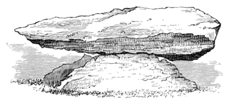 133.Pierre Martine. From Bonstetten.
 - ↑ Delpon, 'Statistique du Dép. du Lot,' i. p. 388.
- ↑ 'Ptolemæi Geo.' Amstel. 1605, p. 47.
- ↑ The only survey of this monument which has been published, and can be depended upon, is that made by Mr. Vicars, a surveyor of Exeter, for the Rev. Dr. Bathurst Deane. It was published by him on a reduced scale in vol. xxv. of the 'Archæologia,' and re-engraved, with the principal parts on the original scale, by Dr. Blair and Mr. Ronalds, in the work before alluded to, but unfortunately never published. The original map, on a scale of 440 feet to 1 inch, is still in Dr. Deane's possession, at Bath, and is so valuable a record of what the monument was thirty-two years ago that it is hoped it may be preserved by some public body. Sir Henry Dryden and the Rev. Mr. Lukis have been employed for some years past exploring and surveying in that neighbourhood, and have brought back perfect plans, on a large scale, of all the principal monuments; and if these were published, they would leave little to be desired in that respect. Meanwhile nothing can exceed Sir Henry's kindness and liberality in allowing access to his treasures, and the use of them by any one who desires it; and I am indebted to him for a great deal of the information in this chapter. The general plans here published are from Messrs. Blair and Ronalds' work, which is quite sufficiently correct for my scale or my present purpose.
- ↑ The form of this enclosure, as will be seen from the plan, is not an exact square, and some of the angle-stones being removed, it is difficult now to ascertain its exact form. Sir Henry Dryden makes it curvilinear. Messrs. Blair and Ronalds make the east side quite straight; the south and west were slightly curvilinear, but the whole figure is quadrangular; which is my own impression of its form.
- ↑ Sir Henry Dryden counts ten rows. Mr. Vicars' survey, from which the woodcut is copied, makes only eight. Their irregularity makes it difficult to feel certain on such a point.
- ↑ 'Journal of Archæological Association,' vol. xxiv. pp. 40 et seqq.
- ↑ Ante, pp. 163 et seq.
- ↑ It is so difficult to realise these similarities, except by representation, that I give here a woodcut of that at Rodmarton. Allowing for the difference of drawing and engraving, the openings are identical, and it is so peculiar in form that the likeness cannot be accidental. If it does not occur anywhere else, or at any other time, it proves, as far as anything can prove, that the French and English long barrows were erected under the same inspiration. If one is post-Roman, so, certainly, is the other; or if one can be proved to be prehistoric, the other must follow.
 140.Entrance to Cell, Rodmarton.
 - ↑ These were exhibited in the inn in the village when I was there. Where they are now, I do not know.
- ↑ 'Revue archéologique,' xii. p. 17.
- ↑ 'Proceedings of Royal Irish Academy,' vol. viii. 1864, p. 298 et seqq.
- ↑ 'Revue archéologique,' vol. x. 1864, pl. iv.
- ↑ Woodcuts No. 145 and 146 are copied from Mr. Ferguson's paper in the 'Proceedings of Royal Irish Academy,' viii. 398 et seqq.
- ↑ These dimensions are from Richard; other authorities make it 18 feet by 12 feet.
- ↑ The existence of the plume is doubted by Sir Henry Dryden, and he is so accurate that he probably is right; but as others say they have seen it, and nothing depends upon it, I have allowed it to remain.
- ↑ It was in a very ruinous state when I saw it five years ago; and there is an ominous silence regarding it among subsequent tourists. The measurements here quoted are from Richard, 'France monumentale.'
- ↑ The plan here given is reduced from one by Sir Henry Dryden, and may be perfectly depended upon as far as the smallness of the scale will allow.
- ↑ Sir Henry drew all these sculptures first on the spot, and afterwards corrected his drawings from the casts at St.-Germain. They are the only drawings existing which can thoroughly be depended upon.
- ↑ A plan of the first-named alignment was published by Freminville, 'Finistère,' part ii. pl. i., but the above particulars and the woodcut are taken from a diagram by Sir Henry Dryden in the last number of the 'Journal of the Anthrop. Inst.' He has perfect plans of the whole.
- ↑ 'Revue archéologique,' new series, ix. pp. 81 et seqq. I may mention that almost every other name in their neighbourhood ends in ac. See 'Joanne Atlas,' dép. Ille-et-Vilaine.
- ↑ Delpon, 'Statistique du Dép. du Lot,' i. 384.
- ↑ "C'est en 465 que Vannes reçut pour premier évêque l'Armoricain St. Patern, qui mourut peu d'années après chez les Francs, où les Goths l'avoient forcé de se réfugier. Modestus en 511 mit tout en œuvre pour repandre le Christianisme parmi les Pagani de son diocèse, mais son zèle ne fut pas recompensé, car plus de trente ans après la mort de Patern les habitans de la Vénétie étoient encore presque tons païens. 'Erant enim tunc temporis Venetenses pene omnes Gentiles.' — Ap. Boll. 'Vita St. Melan.' vi. Jan. p. 311."—Courzon, 'Chartulaire de l'Abbaye de Redon,' cxliii.
- ↑ The authority for these events will be found at length in Gibbon, chap, xviii., and are too familiar to need quoting here.
- ↑ Daru's 'Histoire de la Bretagne,' vol. i. p. 58.
- ↑ Ibid. p. 112.
- ↑ Dom. Bouquet, 'Recueil des Hist. des Gaules,' i. p. 629. "Exuperantius anno circa 416 Armoricos qui a Romanis defecerunt ad officium reducere tentavit."
- ↑ Daru, i. p. 112.
- ↑ "Gradlonus gratia dei rex Britonum necnon ex parte Francorum."—Chartulaire de Landevenec, quoted by P. Lobineau, ii. 17. And further: "Pervenit Sancti (Wingaboei) fama ad Grallonum regem Occiduorum Cornubiensium, gloriosum ultorem Normannorum qui post devictas gentes inimicas sibi duces subduxerat.'—Gurdestan, Moine de Landevenec, 'Vie de St.-Wingabois.'"—Daru, i. p. 69.
- ↑ The information in this table must be received with great limitation. In the first place, What is a dolmen? Do the alignments at Carnac count as two, as seven, or as 700? Many also are mere estimates of local antiquaries. It is, for instance, very doubtful if Finistère contains more monuments than the Morbihan; and subsequent information may introduce great modifications into many of the numbers.
The value of the ac distinction does not come out clearly: first, because of the imperfect mode in which it has been obtained, but more because it does not make it clear that there are in France twenty-nine departments in which there are no dolmens, and no ac-terminations; in fact, the negative evidence which does not appear here is stronger than the positive.

